Loma Chica geodata
Loma Chica (Chihuahua) is a populated place; located in Mexico in America/Chihuahua (GMT-6) time zone. With population of 653 people, there are 13279 cities with bigger population in this country. Compared to other cities in Mexico, 97.4% of cities are located further ↓South; 92.9% of cities are located further →East and 55.4% of cities have higher elevation than Loma Chica. Note1


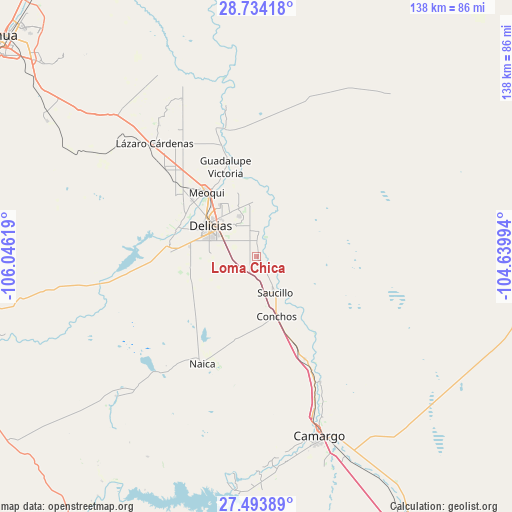
Loma Chica GPS coordinates[2]
28° 6' 56.988" North, 105° 20' 35.016" West
| Map corner | latitude | longitude |
|---|---|---|
| Upper-left | 28.73418°, | -106.04619° |
| Center: | 28.11583°, | -105.34306° |
| Lower-right: | 27.49389°, | -104.63994° |
| Map W x H: | 137.9×137.9 km | = 85.7×85.7mi |
| max Lat: | 32.7° ⇑2.6% North |
| Loma Chica: | 28.11583° |
| min Lat: | ⇓97.4% South 14.53588° |
| min Long | Loma Chica | max Long |
| -117.105° | -105.34306° | -86.73105° |
| W 7.1%⇐ | ⇒92.9% E |
Elevation
Elevation of Loma Chica is 1183 m = 3881 ft, and this is 70.7 m = 232 ft below average elevation for this country.
| Max E: |
3497 m = 11473 ft | 55.4% |
| Avg. | 1253.7 m = 4113 ft | |
| Loma Chica | 1183 m = 3881 ft | |
Min E: |
-1 m = -3 ft | 44.6% |
See also: Mexico elevation on elevation.city.
Geographical zone
Loma Chica is located in North temperate zone (between Tropic of Cancer and the Arctic Circle). Distance of this Northern Tropic circle is 520.3 km =323.3 mi to South.| Distance of | km | miles | from Loma Chica |
|---|---|---|---|
| North Pole | 6880.9 | 4275.6 | to North |
| Arctic Circle | 4275 | 2656.4 | to North |
| Tropic Cancer | 520.3 | 323.3 | to South |
| Equator | 3126.2 | 1942.5 | to South |


Nearby cities:
15 places around Loma Chica: (largest is in red/bold)
• Alvareñas
1.1 km =0.7 mi,  26°
26°
• Ciudad Delicias
14.9 km =9.3 mi,  303°
303°
• Colonia Abraham González (La Quemada)
11.9 km =7.4 mi,  327°
327°
• Colonia Campesina
18.2 km =11.3 mi,  278°
278°
• Colonia Revolución
17.1 km =10.6 mi,  324°
324°
• Colonia Terrazas
18.1 km =11.2 mi, 318°
• Colonia Vicente Guerrero
9.5 km =5.9 mi,  163°
163°
• Colonia Vicente Guerrero
12.4 km =7.7 mi, 317°
• Estación Conchos
16.7 km =10.4 mi, 161°
• Estación Saucillo
10.4 km =6.5 mi,  166°
166°
• Las Varas
4.5 km =2.8 mi,  3°
3°
• Miguel Hidalgo
6.5 km =4 mi,  310°
310°
• Orranteño
7.5 km =4.7 mi, 4°
• Parritas
17.7 km =11 mi,  142°
142°
• Saucillo
10.6 km =6.6 mi,  152°
152°
Sources, notices
• [Note1] Compared only with cities in Mexico existing in our database
• [Src1] Map data: © OpenStreetMap contributors (CC-BY-SA)
• [Src2] Other city data from geonames.org with taken over terms of usage.
• [Src3] Geographical zone / Annual Mean Temperature by Robert A. Rohde @ Wikipedia
