Santa Inés geodata
Santa Inés (Michoacán) is a populated place; located in Mexico in America/Mexico_City (GMT-6) time zone. With population of 502 people, there are 16762 cities with bigger population in this country. Compared to other cities in Mexico, 50.7% of cities are located further ↓South; 84.3% of cities are located further →East and 55.9% of cities have lower elevation than Santa Inés. Note1


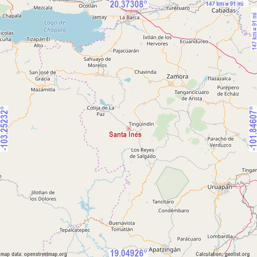
Santa Inés GPS coordinates[2]
19° 42' 45.144" North, 102° 32' 57.084" West
| Map corner | latitude | longitude |
|---|---|---|
| Upper-left | 20.37308°, | -103.25232° |
| Center: | 19.71254°, | -102.54919° |
| Lower-right: | 19.04926°, | -101.84607° |
| Map W x H: | 147.2×147.2 km | = 91.5×91.5mi |
| max Lat: | 32.7° ⇑49.3% North |
| Santa Inés: | 19.71254° |
| min Lat: | ⇓50.7% South 14.53588° |
| min Long | Santa Inés | max Long |
| -117.105° | -102.54919° | -86.73105° |
| W 15.7%⇐ | ⇒84.3% E |
Elevation
Elevation of Santa Inés is 1615 m = 5299 ft, and this is 361.3 m = 1185 ft above average elevation for this country.
| Max E: |
3497 m = 11473 ft | 44.1% |
| Santa Inés | 1615 m 5299 ft | |
| Avg. | 1253.7 m = 4113 ft | |
Min E: |
-1 m = -3 ft | 55.9% |
See also: Mexico elevation on elevation.city.
Geographical zone
Santa Inés is located in North Torrid zone (between Equator and Tropic of Cancer). Distance of this Northern Tropic circle is 414.1 km =257.3 mi to North.| Distance of | km | miles | from Santa Inés |
|---|---|---|---|
| North Pole | 7815.2 | 4856.1 | to North |
| Arctic Circle | 5209.3 | 3236.9 | to North |
| Tropic Cancer | 414.1 | 257.3 | to North |
| Equator | 2191.8 | 1361.9 | to South |


Nearby cities:
15 places around Santa Inés: (largest is in red/bold)
• Atapán
14.7 km =9.1 mi,  117°
117°
• Chaniro (Xhaniro)
11.9 km =7.4 mi,  93°
93°
• Guáscuaro de Múgica
10 km =6.2 mi,  18°
18°
• J. Jesús Díaz Tzirio
17 km =10.6 mi,  69°
69°
• La Higuerita (Colonia San Rafael)
12.5 km =7.8 mi,  147°
147°
• La Tinaja
15.3 km =9.5 mi,  84°
84°
• La Zarzamora
14.2 km =8.8 mi, 94°
• Los Limones
12.6 km =7.8 mi,  171°
171°
• Los Reyes de Salgado
15.8 km =9.8 mi, 149°
• San Sebastián
17.2 km =10.7 mi,  155°
155°
• Santa Clara de Valladares
10.4 km =6.5 mi,  144°
144°
• Tacátzcuaro
2 km =1.2 mi,  5°
5°
• Tarécuato
17 km =10.6 mi,  31°
31°
• Tingüindín
7.7 km =4.8 mi, 67°
• Tocumbo
3 km =1.9 mi,  113°
113°
Sources, notices
• [Note1] Compared only with cities in Mexico existing in our database
• [Src1] Map data: © OpenStreetMap contributors (CC-BY-SA)
• [Src2] Other city data from geonames.org with taken over terms of usage.
• [Src3] Geographical zone / Annual Mean Temperature by Robert A. Rohde @ Wikipedia
