San Sebastián geodata
San Sebastián (Michoacán) is a populated place; located in Mexico in America/Mexico_City (GMT-6) time zone. With population of 2,177 people, there are 4037 cities with bigger population in this country. Compared to other cities in Mexico, 52.6% of cities are located further ↑North; 84% of cities are located further →East and 52.6% of cities have higher elevation than San Sebastián. Note1


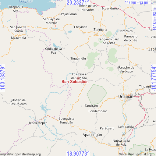
San Sebastián GPS coordinates[2]
19° 34' 17.688" North, 102° 28' 50.376" West
| Map corner | latitude | longitude |
|---|---|---|
| Upper-left | 20.23271°, | -103.18379° |
| Center: | 19.57158°, | -102.48066° |
| Lower-right: | 18.90773°, | -101.77754° |
| Map W x H: | 147.3×147.3 km | = 91.5×91.5mi |
| max Lat: | 32.7° ⇑52.6% North |
| San Sebastián: | 19.57158° |
| min Lat: | ⇓47.4% South 14.53588° |
| min Long | San Sebastián | max Long |
| -117.105° | -102.48066° | -86.73105° |
| W 16%⇐ | ⇒84% E |
Elevation
Elevation of San Sebastián is 1310 m = 4298 ft, and this is 56.3 m = 185 ft above average elevation for this country.
| Max E: |
3497 m = 11473 ft | 52.6% |
| San Sebastián | 1310 m 4298 ft | |
| Avg. | 1253.7 m = 4113 ft | |
Min E: |
-1 m = -3 ft | 47.4% |
See also: Mexico elevation on elevation.city.
Geographical zone
San Sebastián is located in North Torrid zone (between Equator and Tropic of Cancer). Distance of this Northern Tropic circle is 429.8 km =267.1 mi to North.| Distance of | km | miles | from San Sebastián |
|---|---|---|---|
| North Pole | 7830.9 | 4865.9 | to North |
| Arctic Circle | 5225 | 3246.7 | to North |
| Tropic Cancer | 429.8 | 267.1 | to North |
| Equator | 2176.2 | 1352.2 | to South |


Nearby cities:
15 places around San Sebastián: (largest is in red/bold)
• Atapán
10.6 km =6.6 mi,  33°
33°
• Carona
5.9 km =3.7 mi,  147°
147°
• Cherato
14.9 km =9.3 mi,  64°
64°
• Gildardo Magaña (Los Ángeles)
3.4 km =2.1 mi,  137°
137°
• La Higuerita (Colonia San Rafael)
5.2 km =3.2 mi,  355°
355°
• La Palma
15.5 km =9.6 mi,  76°
76°
• Los Limones
6.1 km =3.8 mi,  301°
301°
• Los Palillos
6.8 km =4.2 mi,  240°
240°
• Los Reyes de Salgado
2.3 km =1.4 mi,  22°
22°
• Nuevo Zirosto
14.2 km =8.8 mi,  100°
100°
• Peribán de Ramos
9 km =5.6 mi,  129°
129°
• Plan de Ayala
3.4 km =2.1 mi,  192°
192°
• San Francisco Peribán
8.8 km =5.5 mi, 101°
• Santa Clara de Valladares
7.3 km =4.5 mi,  351°
351°
• Tocumbo
15.1 km =9.4 mi,  342°
342°
Sources, notices
• [Note1] Compared only with cities in Mexico existing in our database
• [Src1] Map data: © OpenStreetMap contributors (CC-BY-SA)
• [Src2] Other city data from geonames.org with taken over terms of usage.
• [Src3] Geographical zone / Annual Mean Temperature by Robert A. Rohde @ Wikipedia
