San Gabriel geodata
San Gabriel (Zacatecas) is a populated place; located in Mexico in America/Mexico_City (GMT-6) time zone. With population of 778 people, there are 11229 cities with bigger population in this country. Compared to other cities in Mexico, 88.6% of cities are located further ↓South; 85.7% of cities are located further →East and 75.8% of cities have lower elevation than San Gabriel. Note1


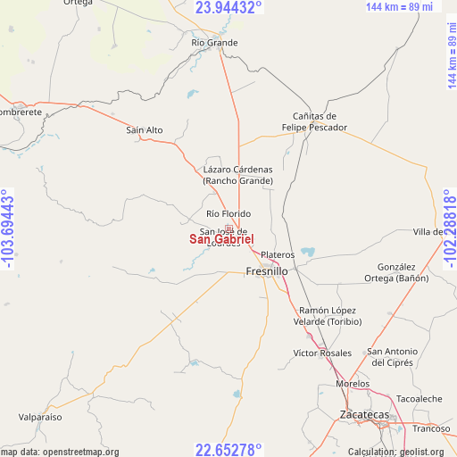
San Gabriel GPS coordinates[2]
23° 18' 0.432" North, 102° 59' 28.68" West
| Map corner | latitude | longitude |
|---|---|---|
| Upper-left | 23.94432°, | -103.69443° |
| Center: | 23.30012°, | -102.9913° |
| Lower-right: | 22.65278°, | -102.28818° |
| Map W x H: | 143.6×143.6 km | = 89.2×89.2mi |
| max Lat: | 32.7° ⇑11.4% North |
| San Gabriel: | 23.30012° |
| min Lat: | ⇓88.6% South 14.53588° |
| min Long | San Gabriel | max Long |
| -117.105° | -102.9913° | -86.73105° |
| W 14.3%⇐ | ⇒85.7% E |
Elevation
Elevation of San Gabriel is 2045 m = 6709 ft, and this is 791.3 m = 2596 ft above average elevation for this country.
| Max E: |
3497 m = 11473 ft | 24.2% |
| San Gabriel | 2045 m 6709 ft | |
| Avg. | 1253.7 m = 4113 ft | |
Min E: |
-1 m = -3 ft | 75.8% |
See also: Mexico elevation on elevation.city.
Geographical zone
San Gabriel is located in North Torrid zone (between Equator and Tropic of Cancer). Distance of this Northern Tropic circle is 15.2 km =9.4 mi to North.| Distance of | km | miles | from San Gabriel |
|---|---|---|---|
| North Pole | 7416.3 | 4608.3 | to North |
| Arctic Circle | 4810.4 | 2989 | to North |
| Tropic Cancer | 15.2 | 9.4 | to North |
| Equator | 2590.7 | 1609.8 | to South |


Nearby cities:
15 places around San Gabriel: (largest is in red/bold)
• Altamira
9.1 km =5.7 mi,  2°
2°
• Carrillo
10.7 km =6.6 mi,  177°
177°
• Colonia Montemariana (Colonia Mariana)
12.7 km =7.9 mi,  283°
283°
• Colonia Plenitud
11.4 km =7.1 mi,  228°
228°
• El Ahijadero
15.5 km =9.6 mi, 278°
• El Baluarte
12.3 km =7.6 mi,  338°
338°
• El Salto
14 km =8.7 mi,  213°
213°
• José María Morelos
3.5 km =2.2 mi,  316°
316°
• México Nuevo Uno (México Nuevo)
13.4 km =8.3 mi,  190°
190°
• Ramón López Velarde
8.7 km =5.4 mi,  111°
111°
• Río Florido
5 km =3.1 mi, 1°
• San Cristóbal
15.3 km =9.5 mi, 205°
• San Ignacio
3 km =1.9 mi,  352°
352°
• San Jose de Lourdes
3.2 km =2 mi,  215°
215°
• Seis de Enero
11.4 km =7.1 mi,  311°
311°
Sources, notices
• [Note1] Compared only with cities in Mexico existing in our database
• [Src1] Map data: © OpenStreetMap contributors (CC-BY-SA)
• [Src2] Other city data from geonames.org with taken over terms of usage.
• [Src3] Geographical zone / Annual Mean Temperature by Robert A. Rohde @ Wikipedia
