Reforma geodata
Reforma (Coahuila) is a populated place; located in Mexico in America/Monterrey (GMT-6) time zone. With population of 635 people, there are 13639 cities with bigger population in this country. Compared to other cities in Mexico, 93.8% of cities are located further ↓South; 87.6% of cities are located further →East and 57.2% of cities have higher elevation than Reforma. Note1


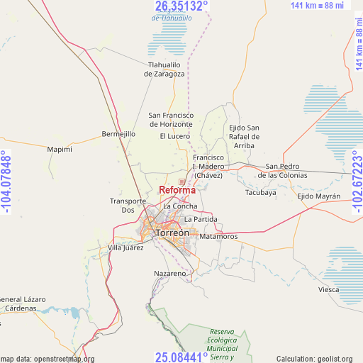
Reforma GPS coordinates[2]
25° 43' 10.38" North, 103° 22' 31.26" West
| Map corner | latitude | longitude |
|---|---|---|
| Upper-left | 26.35132°, | -104.07848° |
| Center: | 25.71955°, | -103.37535° |
| Lower-right: | 25.08441°, | -102.67223° |
| Map W x H: | 140.9×140.9 km | = 87.6×87.6mi |
| max Lat: | 32.7° ⇑6.2% North |
| Reforma: | 25.71955° |
| min Lat: | ⇓93.8% South 14.53588° |
| min Long | Reforma | max Long |
| -117.105° | -103.37535° | -86.73105° |
| W 12.4%⇐ | ⇒87.6% E |
Elevation
Elevation of Reforma is 1118 m = 3668 ft, and this is 135.7 m = 445 ft below average elevation for this country.
| Max E: |
3497 m = 11473 ft | 57.2% |
| Avg. | 1253.7 m = 4113 ft | |
| Reforma | 1118 m = 3668 ft | |
Min E: |
-1 m = -3 ft | 42.8% |
See also: Mexico elevation on elevation.city.
Geographical zone
Reforma is located in North temperate zone (between Tropic of Cancer and the Arctic Circle). Distance of this Northern Tropic circle is 253.8 km =157.7 mi to South.| Distance of | km | miles | from Reforma |
|---|---|---|---|
| North Pole | 7147.3 | 4441.1 | to North |
| Arctic Circle | 4541.4 | 2821.9 | to North |
| Tropic Cancer | 253.8 | 157.7 | to South |
| Equator | 2859.7 | 1776.9 | to South |


Nearby cities:
15 places around Reforma: (largest is in red/bold)
• Albia
6.2 km =3.9 mi,  167°
167°
• California
4.6 km =2.9 mi,  359°
359°
• El Cuije
4.3 km =2.7 mi,  126°
126°
• El Pilar
2.4 km =1.5 mi,  93°
93°
• El Quemado
1.1 km =0.7 mi,  200°
200°
• Escuadrón Doscientos Uno
5.7 km =3.5 mi,  151°
151°
• Esmeralda
6.2 km =3.9 mi,  295°
295°
• Hormiguero
5.2 km =3.2 mi,  139°
139°
• La Flor
4.3 km =2.7 mi, 170°
• La Tehua
5.2 km =3.2 mi,  261°
261°
• San Esteban de Egipto
4.8 km =3 mi,  61°
61°
• San Felipe
3.1 km =1.9 mi,  193°
193°
• Santa Cruz Luján
1.8 km =1.1 mi,  70°
70°
• Veinte de Noviembre
4.7 km =2.9 mi,  100°
100°
• Villa Gregorio García
4.3 km =2.7 mi,  32°
32°
Sources, notices
• [Note1] Compared only with cities in Mexico existing in our database
• [Src1] Map data: © OpenStreetMap contributors (CC-BY-SA)
• [Src2] Other city data from geonames.org with taken over terms of usage.
• [Src3] Geographical zone / Annual Mean Temperature by Robert A. Rohde @ Wikipedia
