Villa de Ramos geodata
Villa de Ramos (San Luis Potosí) is a seat of a second-order administrative division; located in Mexico in America/Mexico_City (GMT-6) time zone. With population of 2,494 people, there are 3545 cities with bigger population in this country. Compared to other cities in Mexico, 87.6% of cities are located further ↓South; 80.4% of cities are located further →East and 82.7% of cities have lower elevation than Villa de Ramos. Note1


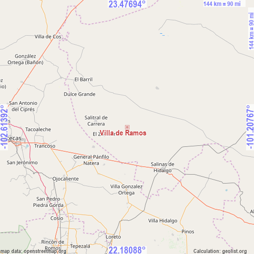
Villa de Ramos GPS coordinates[2]
22° 49' 49.62" North, 101° 54' 38.844" West
| Map corner | latitude | longitude |
|---|---|---|
| Upper-left | 23.47694°, | -102.61392° |
| Center: | 22.83045°, | -101.91079° |
| Lower-right: | 22.18088°, | -101.20767° |
| Map W x H: | 144.1×144.1 km | = 89.5×89.5mi |
| max Lat: | 32.7° ⇑12.4% North |
| Villa de Ramos: | 22.83045° |
| min Lat: | ⇓87.6% South 14.53588° |
| min Long | Villa de Ramos | max Long |
| -117.105° | -101.91079° | -86.73105° |
| W 19.6%⇐ | ⇒80.4% E |
Elevation
Elevation of Villa de Ramos is 2206 m = 7238 ft, and this is 952.3 m = 3124 ft above average elevation for this country.
| Max E: |
3497 m = 11473 ft | 17.3% |
| Villa de Ramos | 2206 m 7238 ft | |
| Avg. | 1253.7 m = 4113 ft | |
Min E: |
-1 m = -3 ft | 82.7% |
See also: Mexico elevation on elevation.city.
Geographical zone
Villa de Ramos is located in North Torrid zone (between Equator and Tropic of Cancer). Distance of this Northern Tropic circle is 67.4 km =41.9 mi to North.| Distance of | km | miles | from Villa de Ramos |
|---|---|---|---|
| North Pole | 7468.6 | 4640.8 | to North |
| Arctic Circle | 4862.7 | 3021.5 | to North |
| Tropic Cancer | 67.4 | 41.9 | to North |
| Equator | 2538.5 | 1577.4 | to South |


Nearby cities:
15 places around Villa de Ramos: (largest is in red/bold)
• Colonia Diez de Noviembre (El Campamento)
24.1 km =15 mi,  185°
185°
• El Saucito (El Horno)
21.9 km =13.6 mi,  239°
239°
• El Tule
24.8 km =15.4 mi,  211°
211°
• Hernández
26 km =16.2 mi,  330°
330°
• La Dulcita
8.4 km =5.2 mi,  307°
307°
• La Tesorera
25.8 km =16 mi,  234°
234°
• Los Zacatones
20.8 km =12.9 mi, 314°
• Noria del Cerro de Santiago (El Cerro)
22 km =13.7 mi,  249°
249°
• Palma Pegada
18.1 km =11.2 mi,  137°
137°
• Punteros
15.8 km =9.8 mi,  124°
124°
• Salitral de Carrera
18.1 km =11.2 mi,  282°
282°
• Salitrillo
22.4 km =13.9 mi, 141°
• San Francisco
19.1 km =11.9 mi,  353°
353°
• San José el Saladillo (El Saladillo)
20.8 km =12.9 mi,  218°
218°
• Santa Lucía
5.1 km =3.2 mi, 189°
Sources, notices
• [Note1] Compared only with cities in Mexico existing in our database
• [Src1] Map data: © OpenStreetMap contributors (CC-BY-SA)
• [Src2] Other city data from geonames.org with taken over terms of usage.
• [Src3] Geographical zone / Annual Mean Temperature by Robert A. Rohde @ Wikipedia
