El Tule geodata
El Tule (Zacatecas) is a populated place; located in Mexico in America/Mexico_City (GMT-6) time zone. With population of 1,383 people, there are 6258 cities with bigger population in this country. Compared to other cities in Mexico, 87.2% of cities are located further ↓South; 81.2% of cities are located further →East and 75.2% of cities have lower elevation than El Tule. Note1


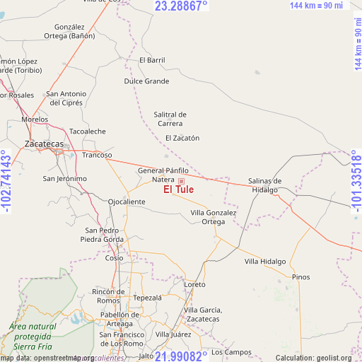
El Tule GPS coordinates[2]
22° 38' 28.608" North, 102° 2' 17.88" West
| Map corner | latitude | longitude |
|---|---|---|
| Upper-left | 23.28867°, | -102.74143° |
| Center: | 22.64128°, | -102.0383° |
| Lower-right: | 21.99082°, | -101.33518° |
| Map W x H: | 144.3×144.3 km | = 89.7×89.7mi |
| max Lat: | 32.7° ⇑12.8% North |
| El Tule: | 22.64128° |
| min Lat: | ⇓87.2% South 14.53588° |
| min Long | El Tule | max Long |
| -117.105° | -102.0383° | -86.73105° |
| W 18.8%⇐ | ⇒81.2% E |
Elevation
Elevation of El Tule is 2034 m = 6673 ft, and this is 780.3 m = 2560 ft above average elevation for this country.
| Max E: |
3497 m = 11473 ft | 24.8% |
| El Tule | 2034 m 6673 ft | |
| Avg. | 1253.7 m = 4113 ft | |
Min E: |
-1 m = -3 ft | 75.2% |
See also: Mexico elevation on elevation.city.
Geographical zone
El Tule is located in North Torrid zone (between Equator and Tropic of Cancer). Distance of this Northern Tropic circle is 88.4 km =54.9 mi to North.| Distance of | km | miles | from El Tule |
|---|---|---|---|
| North Pole | 7489.6 | 4653.8 | to North |
| Arctic Circle | 4883.7 | 3034.6 | to North |
| Tropic Cancer | 88.4 | 54.9 | to North |
| Equator | 2517.5 | 1564.3 | to South |


Nearby cities:
15 places around El Tule: (largest is in red/bold)
• Bajío de San Nicolás
9 km =5.6 mi,  159°
159°
• Colonia Diez de Noviembre (El Campamento)
11.2 km =7 mi,  105°
105°
• El Saucito (El Horno)
11.6 km =7.2 mi,  329°
329°
• Estancia de Ánimas
17.6 km =10.9 mi,  165°
165°
• General Pánfilo Natera
7.8 km =4.8 mi,  289°
289°
• Guanajuatillo
13.6 km =8.5 mi,  307°
307°
• La Tesorera
10.2 km =6.3 mi, 307°
• Noria del Cerro de Santiago (El Cerro)
15.4 km =9.6 mi, 330°
• Pozo de Jarillas
16.4 km =10.2 mi,  274°
274°
• Rancho Nuevo
8.8 km =5.5 mi,  246°
246°
• San José el Saladillo (El Saladillo)
4.9 km =3 mi,  0°
0°
• San Pablo
11.1 km =6.9 mi,  214°
214°
• San Ramón
9.9 km =6.2 mi, 268°
• Santa Elena
6.4 km =4 mi, 212°
• Santo Tomás Venaditos (Venaditos)
15 km =9.3 mi, 207°
Sources, notices
• [Note1] Compared only with cities in Mexico existing in our database
• [Src1] Map data: © OpenStreetMap contributors (CC-BY-SA)
• [Src2] Other city data from geonames.org with taken over terms of usage.
• [Src3] Geographical zone / Annual Mean Temperature by Robert A. Rohde @ Wikipedia
