Plan de Ayala geodata
Plan de Ayala (Michoacán) is a populated place; located in Mexico in America/Mexico_City (GMT-6) time zone. With population of 510 people, there are 16480 cities with bigger population in this country. Compared to other cities in Mexico, 53.2% of cities are located further ↑North; 84% of cities are located further →East and 52.8% of cities have higher elevation than Plan de Ayala. Note1


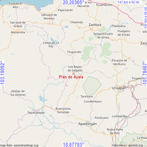
Plan de Ayala GPS coordinates[2]
19° 32' 30.48" North, 102° 29' 16.044" West
| Map corner | latitude | longitude |
|---|---|---|
| Upper-left | 20.20305°, | -103.19092° |
| Center: | 19.5418°, | -102.48779° |
| Lower-right: | 18.87783°, | -101.78467° |
| Map W x H: | 147.4×147.4 km | = 91.6×91.6mi |
| max Lat: | 32.7° ⇑53.2% North |
| Plan de Ayala: | 19.5418° |
| min Lat: | ⇓46.8% South 14.53588° |
| min Long | Plan de Ayala | max Long |
| -117.105° | -102.48779° | -86.73105° |
| W 16%⇐ | ⇒84% E |
Elevation
Elevation of Plan de Ayala is 1298 m = 4259 ft, and this is 44.3 m = 145 ft above average elevation for this country.
| Max E: |
3497 m = 11473 ft | 52.8% |
| Plan de Ayala | 1298 m 4259 ft | |
| Avg. | 1253.7 m = 4113 ft | |
Min E: |
-1 m = -3 ft | 47.2% |
See also: Mexico elevation on elevation.city.
Geographical zone
Plan de Ayala is located in North Torrid zone (between Equator and Tropic of Cancer). Distance of this Northern Tropic circle is 433.1 km =269.1 mi to North.| Distance of | km | miles | from Plan de Ayala |
|---|---|---|---|
| North Pole | 7834.2 | 4867.9 | to North |
| Arctic Circle | 5228.3 | 3248.7 | to North |
| Tropic Cancer | 433.1 | 269.1 | to North |
| Equator | 2172.8 | 1350.1 | to South |


Nearby cities:
15 places around Plan de Ayala: (largest is in red/bold)
• Apo
15.1 km =9.4 mi,  147°
147°
• Atapán
13.8 km =8.6 mi,  28°
28°
• Carona
4.2 km =2.6 mi,  113°
113°
• Cherato
17.2 km =10.7 mi,  55°
55°
• Gildardo Magaña (Los Ángeles)
3.2 km =2 mi,  75°
75°
• La Higuerita (Colonia San Rafael)
8.5 km =5.3 mi,  2°
2°
• Los Limones
7.9 km =4.9 mi,  325°
325°
• Los Palillos
5.1 km =3.2 mi,  269°
269°
• Los Reyes de Salgado
5.6 km =3.5 mi,  16°
16°
• Nuevo Zirosto
14.7 km =9.1 mi,  87°
87°
• Peribán de Ramos
8.1 km =5 mi, 107°
• San Francisco Peribán
9.5 km =5.9 mi, 80°
• San Sebastián
3.4 km =2.1 mi,  12°
12°
• Santa Ana Zirosto
17.1 km =10.6 mi, 92°
• Santa Clara de Valladares
10.5 km =6.5 mi,  358°
358°
Sources, notices
• [Note1] Compared only with cities in Mexico existing in our database
• [Src1] Map data: © OpenStreetMap contributors (CC-BY-SA)
• [Src2] Other city data from geonames.org with taken over terms of usage.
• [Src3] Geographical zone / Annual Mean Temperature by Robert A. Rohde @ Wikipedia
