Nuevo Zirosto geodata
Nuevo Zirosto (Michoacán) is a populated place; located in Mexico in America/Mexico_City (GMT-6) time zone. With population of 2,239 people, there are 3924 cities with bigger population in this country. Compared to other cities in Mexico, 53.1% of cities are located further ↑North; 83.2% of cities are located further →East and 69.4% of cities have lower elevation than Nuevo Zirosto. Note1


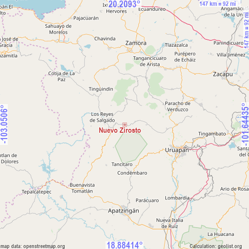
Nuevo Zirosto GPS coordinates[2]
19° 32' 53.088" North, 102° 20' 50.892" West
| Map corner | latitude | longitude |
|---|---|---|
| Upper-left | 20.2093°, | -103.0506° |
| Center: | 19.54808°, | -102.34747° |
| Lower-right: | 18.88414°, | -101.64435° |
| Map W x H: | 147.3×147.3 km | = 91.5×91.5mi |
| max Lat: | 32.7° ⇑53.1% North |
| Nuevo Zirosto: | 19.54808° |
| min Lat: | ⇓46.9% South 14.53588° |
| min Long | Nuevo Zirosto | max Long |
| -117.105° | -102.34747° | -86.73105° |
| W 16.8%⇐ | ⇒83.2% E |
Elevation
Elevation of Nuevo Zirosto is 1914 m = 6280 ft, and this is 660.3 m = 2166 ft above average elevation for this country.
| Max E: |
3497 m = 11473 ft | 30.6% |
| Nuevo Zirosto | 1914 m 6280 ft | |
| Avg. | 1253.7 m = 4113 ft | |
Min E: |
-1 m = -3 ft | 69.4% |
See also: Mexico elevation on elevation.city.
Geographical zone
Nuevo Zirosto is located in North Torrid zone (between Equator and Tropic of Cancer). Distance of this Northern Tropic circle is 432.4 km =268.7 mi to North.| Distance of | km | miles | from Nuevo Zirosto |
|---|---|---|---|
| North Pole | 7833.5 | 4867.5 | to North |
| Arctic Circle | 5227.6 | 3248.3 | to North |
| Tropic Cancer | 432.4 | 268.7 | to North |
| Equator | 2173.5 | 1350.5 | to South |


Nearby cities:
15 places around Nuevo Zirosto: (largest is in red/bold)
• Angahuán
12.8 km =8 mi,  90°
90°
• Atapán
14 km =8.7 mi,  324°
324°
• Carona
11.1 km =6.9 mi,  257°
257°
• Cherato
9.1 km =5.7 mi,  356°
356°
• Corupo
13.6 km =8.5 mi,  60°
60°
• Gildardo Magaña (Los Ángeles)
11.6 km =7.2 mi,  270°
270°
• La Palma
6.3 km =3.9 mi,  10°
10°
• Los Reyes de Salgado
13.9 km =8.6 mi,  289°
289°
• Peribán de Ramos
7.6 km =4.7 mi,  245°
245°
• Plan de Ayala
14.7 km =9.1 mi, 267°
• San Francisco Peribán
5.4 km =3.4 mi,  279°
279°
• San Sebastián
14.2 km =8.8 mi, 280°
• Santa Ana Zirosto
2.8 km =1.7 mi,  120°
120°
• Zacán
6.6 km =4.1 mi,  72°
72°
• Zicuicho
12.9 km =8 mi, 6°
Sources, notices
• [Note1] Compared only with cities in Mexico existing in our database
• [Src1] Map data: © OpenStreetMap contributors (CC-BY-SA)
• [Src2] Other city data from geonames.org with taken over terms of usage.
• [Src3] Geographical zone / Annual Mean Temperature by Robert A. Rohde @ Wikipedia
