Obispo geodata
Obispo (Sinaloa) is a populated place; located in Mexico in America/Mazatlan (GMT-7) time zone. With population of 775 people, there are 11274 cities with bigger population in this country. Compared to other cities in Mexico, 90.6% of cities are located further ↓South; 94.5% of cities are located further →East and 82.2% of cities have higher elevation than Obispo. Note1


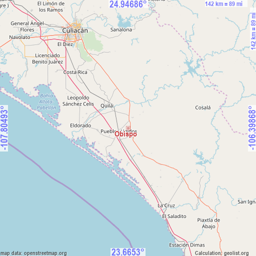
Obispo GPS coordinates[2]
24° 18' 27.72" North, 107° 6' 6.48" West
| Map corner | latitude | longitude |
|---|---|---|
| Upper-left | 24.94686°, | -107.80493° |
| Center: | 24.3077°, | -107.1018° |
| Lower-right: | 23.6653°, | -106.39868° |
| Map W x H: | 142.5×142.5 km | = 88.5×88.5mi |
| max Lat: | 32.7° ⇑9.4% North |
| Obispo: | 24.3077° |
| min Lat: | ⇓90.6% South 14.53588° |
| min Long | Obispo | max Long |
| -117.105° | -107.1018° | -86.73105° |
| W 5.5%⇐ | ⇒94.5% E |
Elevation
Elevation of Obispo is 68 m = 223 ft, and this is 1185.7 m = 3890 ft below average elevation for this country.
| Max E: |
3497 m = 11473 ft | 82.2% |
| Avg. | 1253.7 m = 4113 ft | |
| Obispo | 68 m = 223 ft | |
Min E: |
-1 m = -3 ft | 17.8% |
See also: Mexico elevation on elevation.city.
Geographical zone
Obispo is located in North temperate zone (between Tropic of Cancer and the Arctic Circle). Distance of this Northern Tropic circle is 96.8 km =60.1 mi to South.| Distance of | km | miles | from Obispo |
|---|---|---|---|
| North Pole | 7304.3 | 4538.7 | to North |
| Arctic Circle | 4698.4 | 2919.4 | to North |
| Tropic Cancer | 96.8 | 60.1 | to South |
| Equator | 2702.8 | 1679.4 | to South |


Nearby cities:
15 places around Obispo: (largest is in red/bold)
• Abuya y Ceuta Segunda (Ejido Echeverría)
8.1 km =5 mi,  212°
212°
• Chiqueritos
15.6 km =9.7 mi,  155°
155°
• Colonia Emancipación
11.3 km =7 mi,  248°
248°
• El Rosario
10 km =6.2 mi,  234°
234°
• El Sinaloense
15.6 km =9.7 mi,  258°
258°
• Estación Obispo
6.1 km =3.8 mi, 254°
• Guadalupe Victoria
17.1 km =10.6 mi,  266°
266°
• Higueras de Abuya
6.1 km =3.8 mi,  149°
149°
• Jacola
14.1 km =8.8 mi,  201°
201°
• La Loma (La Loma de Quila)
15 km =9.3 mi,  302°
302°
• Oso Viejo
12.4 km =7.7 mi,  325°
325°
• Pueblos Unidos
5.3 km =3.3 mi, 251°
• Quila
17.7 km =11 mi,  316°
316°
• San Francisco de Tacuichamona
6.5 km =4 mi,  23°
23°
• Tabalá
15 km =9.3 mi,  2°
2°
Sources, notices
• [Note1] Compared only with cities in Mexico existing in our database
• [Src1] Map data: © OpenStreetMap contributors (CC-BY-SA)
• [Src2] Other city data from geonames.org with taken over terms of usage.
• [Src3] Geographical zone / Annual Mean Temperature by Robert A. Rohde @ Wikipedia
