Abuya y Ceuta Segunda (Ejido Echeverría) geodata
Abuya y Ceuta Segunda (Ejido Echeverría) (Sinaloa) is a populated place; located in Mexico in America/Mazatlan (GMT-7) time zone. With population of 583 people, there are 14713 cities with bigger population in this country. Compared to other cities in Mexico, 90.5% of cities are located further ↓South; 94.5% of cities are located further →East and 89% of cities have higher elevation than Abuya y Ceuta Segunda (Ejido Echeverría). Note1
Current local time in Abuya y Ceuta Segunda (Ejido Echeverría):
09:04 AM, MondayDifference from your time zone: hours


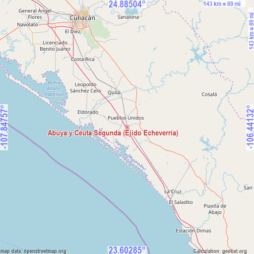
Abuya y Ceuta Segunda (Ejido Echeverría) GPS coordinates[2]
24° 14' 44.016" North, 107° 8' 39.984" West
| Map corner | latitude | longitude |
|---|---|---|
| Upper-left | 24.88504°, | -107.84757° |
| Center: | 24.24556°, | -107.14444° |
| Lower-right: | 23.60285°, | -106.44132° |
| Map W x H: | 142.6×142.6 km | = 88.6×88.6mi |
| max Lat: | 32.7° ⇑9.5% North |
| Abuya y Ceuta Segunda (Ejido Echeverría): | 24.24556° |
| min Lat: | ⇓90.5% South 14.53588° |
| min Long | Abuya y Ceuta S | max Long |
| -117.105° | -107.14444° | -86.73105° |
| W 5.5%⇐ | ⇒94.5% E |
Elevation
Elevation of Abuya y Ceuta Segunda (Ejido Echeverría) is 27 m = 89 ft, and this is 1226.7 m = 4025 ft below average elevation for this country.
| Max E: |
3497 m = 11473 ft | 89% |
| Avg. | 1253.7 m = 4113 ft | |
| Abuya y Ceuta Segunda (Ejido Echeverría) | 27 m = 89 ft | |
Min E: |
-1 m = -3 ft | 11% |
See also: Mexico elevation on elevation.city.
Geographical zone
Abuya y Ceuta Segunda (Ejido Echeverría) is located in North temperate zone (between Tropic of Cancer and the Arctic Circle). Distance of this Northern Tropic circle is 89.9 km =55.9 mi to South.| Distance of | km | miles | from Abuya y Ceuta Segunda (Ejido Echeverría) |
|---|---|---|---|
| North Pole | 7311.2 | 4543 | to North |
| Arctic Circle | 4705.3 | 2923.7 | to North |
| Tropic Cancer | 89.9 | 55.9 | to South |
| Equator | 2695.9 | 1675.2 | to South |


Nearby cities:
15 places around Abuya y Ceuta Segunda (Ejido Echeverría): (largest is in red/bold)
• Chiqueritos
13 km =8.1 mi,  124°
124°
• Colonia Emancipación
6.7 km =4.2 mi,  294°
294°
• Cospita
15.7 km =9.8 mi,  174°
174°
• El Rosario
4 km =2.5 mi, 285°
• El Sinaloense
11.6 km =7.2 mi, 289°
• Estación Obispo
5.5 km =3.4 mi,  343°
343°
• Guadalupe Victoria
14.1 km =8.8 mi,  295°
295°
• Higueras de Abuya
7.6 km =4.7 mi,  77°
77°
• Jacola
6.3 km =3.9 mi,  187°
187°
• La Loma (La Loma de Quila)
17.2 km =10.7 mi,  331°
331°
• Obispo
8.1 km =5 mi,  32°
32°
• Oso Viejo
17.3 km =10.7 mi,  350°
350°
• Península de Villamoros
11.8 km =7.3 mi,  222°
222°
• Pueblos Unidos
5.3 km =3.3 mi, 352°
• San Francisco de Tacuichamona
14.6 km =9.1 mi, 28°
Sources, notices
• [Note1] Compared only with cities in Mexico existing in our database
• [Src1] Map data: © OpenStreetMap contributors (CC-BY-SA)
• [Src2] Other city data from geonames.org with taken over terms of usage.
• [Src3] Geographical zone / Annual Mean Temperature by Robert A. Rohde @ Wikipedia
