Llano Grande geodata
Llano Grande (Durango) is a populated place; located in Mexico in America/Monterrey (GMT-6) time zone. With population of 1,938 people, there are 4490 cities with bigger population in this country. Compared to other cities in Mexico, 89.6% of cities are located further ↓South; 92.4% of cities are located further →East and 89.9% of cities have lower elevation than Llano Grande. Note1


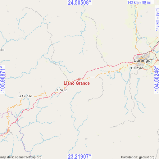
Llano Grande GPS coordinates[2]
23° 51' 49.212" North, 105° 12' 20.088" West
| Map corner | latitude | longitude |
|---|---|---|
| Upper-left | 24.50508°, | -105.90871° |
| Center: | 23.86367°, | -105.20558° |
| Lower-right: | 23.21907°, | -104.50246° |
| Map W x H: | 143×143 km | = 88.9×88.9mi |
| max Lat: | 32.7° ⇑10.4% North |
| Llano Grande: | 23.86367° |
| min Lat: | ⇓89.6% South 14.53588° |
| min Long | Llano Grande | max Long |
| -117.105° | -105.20558° | -86.73105° |
| W 7.6%⇐ | ⇒92.4% E |
Elevation
Elevation of Llano Grande is 2403 m = 7884 ft, and this is 1149.3 m = 3771 ft above average elevation for this country.
| Max E: |
3497 m = 11473 ft | 10.1% |
| Llano Grande | 2403 m 7884 ft | |
| Avg. | 1253.7 m = 4113 ft | |
Min E: |
-1 m = -3 ft | 89.9% |
See also: Mexico elevation on elevation.city.
Geographical zone
Llano Grande is located in North temperate zone (between Tropic of Cancer and the Arctic Circle). Distance of this Northern Tropic circle is 47.5 km =29.5 mi to South.| Distance of | km | miles | from Llano Grande |
|---|---|---|---|
| North Pole | 7353.7 | 4569.4 | to North |
| Arctic Circle | 4747.8 | 2950.1 | to North |
| Tropic Cancer | 47.5 | 29.5 | to South |
| Equator | 2653.4 | 1648.7 | to South |


Nearby cities:
15 places around Llano Grande: (largest is in red/bold)
• Banderas del Águila
15.3 km =9.5 mi,  296°
296°
• Chavarría Nuevo
45.8 km =28.5 mi,  238°
238°
• El Mil Diez
19.9 km =12.4 mi,  249°
249°
• El Nayar
53 km =32.9 mi,  77°
77°
• El Pueblito
50.9 km =31.6 mi, 76°
• El Refugio (El Conejo)
52.8 km =32.8 mi, 76°
• El Salto
18.5 km =11.5 mi, 239°
• Estación Coyotes (José María Morelos)
11.1 km =6.9 mi,  269°
269°
• General Máximo García
41.2 km =25.6 mi,  73°
73°
• La Ciudad
51.3 km =31.9 mi, 253°
• La Peña
37 km =23 mi,  207°
207°
• Llano Grande de Milpillas Chico
53.1 km =33 mi,  161°
161°
• Pueblo Nuevo
56.8 km =35.3 mi,  198°
198°
• San Bernardino de Milpillas Chico
53.5 km =33.2 mi,  174°
174°
• San Jerónimo
35 km =21.7 mi,  260°
260°
Sources, notices
• [Note1] Compared only with cities in Mexico existing in our database
• [Src1] Map data: © OpenStreetMap contributors (CC-BY-SA)
• [Src2] Other city data from geonames.org with taken over terms of usage.
• [Src3] Geographical zone / Annual Mean Temperature by Robert A. Rohde @ Wikipedia
