La Trinidad geodata
La Trinidad (Sinaloa) is a populated place; located in Mexico in America/Mazatlan (GMT-7) time zone. With population of 4,230 people, there are 2172 cities with bigger population in this country. Compared to other cities in Mexico, 93.9% of cities are located further ↓South; 96.4% of cities are located further →East and 86.5% of cities have higher elevation than La Trinidad. Note1


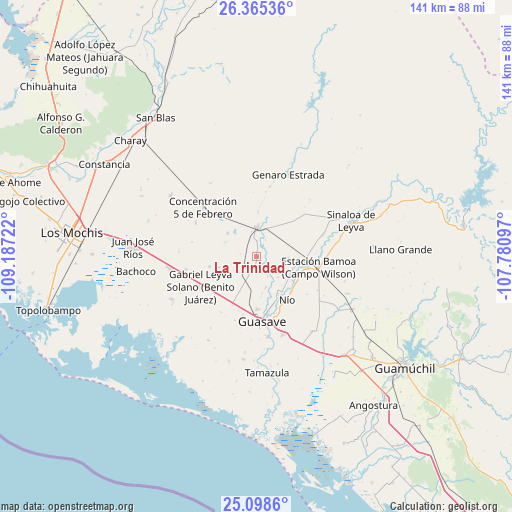
La Trinidad GPS coordinates[2]
25° 44' 1.212" North, 108° 29' 2.724" West
| Map corner | latitude | longitude |
|---|---|---|
| Upper-left | 26.36536°, | -109.18722° |
| Center: | 25.73367°, | -108.48409° |
| Lower-right: | 25.0986°, | -107.78097° |
| Map W x H: | 140.9×140.9 km | = 87.6×87.6mi |
| max Lat: | 32.7° ⇑6.1% North |
| La Trinidad: | 25.73367° |
| min Lat: | ⇓93.9% South 14.53588° |
| min Long | La Trinidad | max Long |
| -117.105° | -108.48409° | -86.73105° |
| W 3.6%⇐ | ⇒96.4% E |
Elevation
Elevation of La Trinidad is 36 m = 118 ft, and this is 1217.7 m = 3995 ft below average elevation for this country.
| Max E: |
3497 m = 11473 ft | 86.5% |
| Avg. | 1253.7 m = 4113 ft | |
| La Trinidad | 36 m = 118 ft | |
Min E: |
-1 m = -3 ft | 13.5% |
See also: Mexico elevation on elevation.city.
Geographical zone
La Trinidad is located in North temperate zone (between Tropic of Cancer and the Arctic Circle). Distance of this Northern Tropic circle is 255.4 km =158.7 mi to South.| Distance of | km | miles | from La Trinidad |
|---|---|---|---|
| North Pole | 7145.7 | 4440.1 | to North |
| Arctic Circle | 4539.9 | 2821 | to North |
| Tropic Cancer | 255.4 | 158.7 | to South |
| Equator | 2861.3 | 1777.9 | to South |


Nearby cities:
15 places around La Trinidad: (largest is in red/bold)
• Carboneras
11.4 km =7.1 mi,  102°
102°
• Ejido Abelardo L. Rodríguez
4.4 km =2.7 mi,  254°
254°
• Ejido Playa Segunda
9.9 km =6.2 mi,  33°
33°
• El Sabino
10.7 km =6.6 mi,  121°
121°
• Gabriel Leyva Velázquez
10.2 km =6.3 mi,  308°
308°
• La Escalera
11.3 km =7 mi,  173°
173°
• La Noria
2.8 km =1.7 mi,  195°
195°
• La Presita
10.5 km =6.5 mi, 253°
• Las Juntas de Chamicari
8.3 km =5.2 mi,  132°
132°
• Las Moras
8.9 km =5.5 mi,  162°
162°
• Las Quemazones
6.2 km =3.9 mi,  149°
149°
• Naranjo
8.1 km =5 mi,  2°
2°
• Portugués de Gálvez
8.9 km =5.5 mi,  94°
94°
• Ranchito de Inzunza
10.1 km =6.3 mi, 170°
• San Sebastián Número Dos
10.9 km =6.8 mi, 127°
Sources, notices
• [Note1] Compared only with cities in Mexico existing in our database
• [Src1] Map data: © OpenStreetMap contributors (CC-BY-SA)
• [Src2] Other city data from geonames.org with taken over terms of usage.
• [Src3] Geographical zone / Annual Mean Temperature by Robert A. Rohde @ Wikipedia
