Las Fuentes geodata
Las Fuentes (Michoacán) is a populated place; located in Mexico in America/Mexico_City (GMT-6) time zone. With population of 558 people, there are 15286 cities with bigger population in this country. Compared to other cities in Mexico, 60.4% of cities are located further ↓South; 82.1% of cities are located further →East and 54.1% of cities have lower elevation than Las Fuentes. Note1


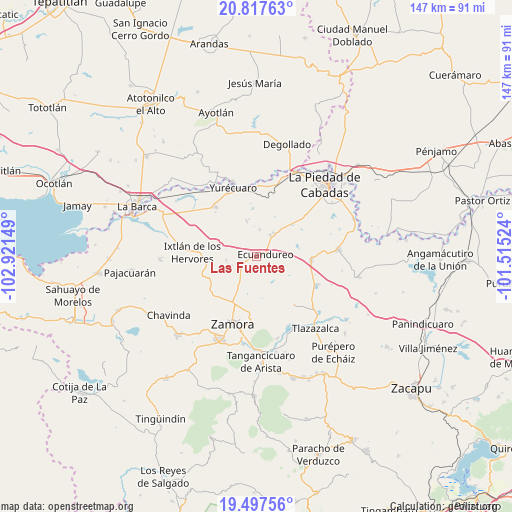
Las Fuentes GPS coordinates[2]
20° 9' 32.364" North, 102° 13' 6.096" West
| Map corner | latitude | longitude |
|---|---|---|
| Upper-left | 20.81763°, | -102.92149° |
| Center: | 20.15899°, | -102.21836° |
| Lower-right: | 19.49756°, | -101.51524° |
| Map W x H: | 146.8×146.8 km | = 91.2×91.2mi |
| max Lat: | 32.7° ⇑39.6% North |
| Las Fuentes: | 20.15899° |
| min Lat: | ⇓60.4% South 14.53588° |
| min Long | Las Fuentes | max Long |
| -117.105° | -102.21836° | -86.73105° |
| W 17.9%⇐ | ⇒82.1% E |
Elevation
Elevation of Las Fuentes is 1564 m = 5131 ft, and this is 310.3 m = 1018 ft above average elevation for this country.
| Max E: |
3497 m = 11473 ft | 45.9% |
| Las Fuentes | 1564 m 5131 ft | |
| Avg. | 1253.7 m = 4113 ft | |
Min E: |
-1 m = -3 ft | 54.1% |
See also: Mexico elevation on elevation.city.
Geographical zone
Las Fuentes is located in North Torrid zone (between Equator and Tropic of Cancer). Distance of this Northern Tropic circle is 364.4 km =226.4 mi to North.| Distance of | km | miles | from Las Fuentes |
|---|---|---|---|
| North Pole | 7765.6 | 4825.3 | to North |
| Arctic Circle | 5159.7 | 3206.1 | to North |
| Tropic Cancer | 364.4 | 226.4 | to North |
| Equator | 2241.5 | 1392.8 | to South |


Nearby cities:
15 places around Las Fuentes: (largest is in red/bold)
• Atacheo de Regalado
11.6 km =7.2 mi,  163°
163°
• Atecucario de la Constitución (Atecuario)
10.7 km =6.6 mi,  191°
191°
• Ecuandureo
2.6 km =1.6 mi,  82°
82°
• El Colesio
8.7 km =5.4 mi,  262°
262°
• El Refugio
13.4 km =8.3 mi,  354°
354°
• El Sauz de Abajo
10.7 km =6.6 mi,  209°
209°
• La Noria
13.5 km =8.4 mi,  74°
74°
• La Rinconoda
14.8 km =9.2 mi, 209°
• La Soledad
7.6 km =4.7 mi,  6°
6°
• Las Cieneguitas
10.4 km =6.5 mi,  344°
344°
• Los Guajes
13.9 km =8.6 mi,  35°
35°
• Rincón Grande
8.2 km =5.1 mi, 36°
• Romero de Guzmán
15 km =9.3 mi,  196°
196°
• Tinaja de Vargas
9.7 km =6 mi,  304°
304°
• Ucácuaro
2.3 km =1.4 mi, 256°
Sources, notices
• [Note1] Compared only with cities in Mexico existing in our database
• [Src1] Map data: © OpenStreetMap contributors (CC-BY-SA)
• [Src2] Other city data from geonames.org with taken over terms of usage.
• [Src3] Geographical zone / Annual Mean Temperature by Robert A. Rohde @ Wikipedia
