Atacheo de Regalado geodata
Atacheo de Regalado (Michoacán) is a populated place; located in Mexico in America/Mexico_City (GMT-6) time zone. With population of 1,425 people, there are 6062 cities with bigger population in this country. Compared to other cities in Mexico, 58.2% of cities are located further ↓South; 81.9% of cities are located further →East and 56.1% of cities have lower elevation than Atacheo de Regalado. Note1


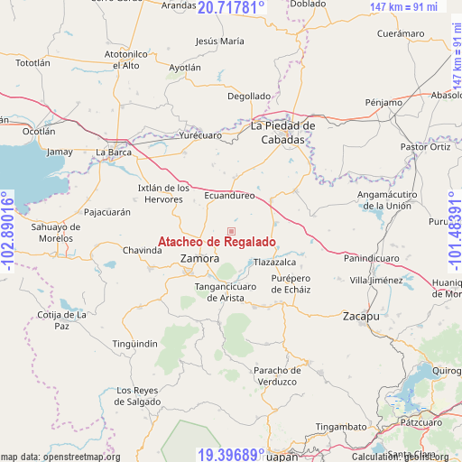
Atacheo de Regalado GPS coordinates[2]
20° 3' 31.464" North, 102° 11' 13.308" West
| Map corner | latitude | longitude |
|---|---|---|
| Upper-left | 20.71781°, | -102.89016° |
| Center: | 20.05874°, | -102.18703° |
| Lower-right: | 19.39689°, | -101.48391° |
| Map W x H: | 146.9×146.9 km | = 91.3×91.3mi |
| max Lat: | 32.7° ⇑41.8% North |
| Atacheo de Regalado: | 20.05874° |
| min Lat: | ⇓58.2% South 14.53588° |
| min Long | Atacheo de Rega | max Long |
| -117.105° | -102.18703° | -86.73105° |
| W 18.1%⇐ | ⇒81.9% E |
Elevation
Elevation of Atacheo de Regalado is 1621 m = 5318 ft, and this is 367.3 m = 1205 ft above average elevation for this country.
| Max E: |
3497 m = 11473 ft | 43.9% |
| Atacheo de Regalado | 1621 m 5318 ft | |
| Avg. | 1253.7 m = 4113 ft | |
Min E: |
-1 m = -3 ft | 56.1% |
See also: Mexico elevation on elevation.city.
Geographical zone
Atacheo de Regalado is located in North Torrid zone (between Equator and Tropic of Cancer). Distance of this Northern Tropic circle is 375.6 km =233.4 mi to North.| Distance of | km | miles | from Atacheo de Regalado |
|---|---|---|---|
| North Pole | 7776.7 | 4832.2 | to North |
| Arctic Circle | 5170.9 | 3213 | to North |
| Tropic Cancer | 375.6 | 233.4 | to North |
| Equator | 2230.3 | 1385.8 | to South |


Nearby cities:
15 places around Atacheo de Regalado: (largest is in red/bold)
• Aquiles Serdán
6.8 km =4.2 mi,  206°
206°
• Atecucario de la Constitución (Atecuario)
5.4 km =3.4 mi,  276°
276°
• Colonia Linda Vista
9.9 km =6.2 mi,  217°
217°
• Colonia Primero de Mayo (La Beatilla)
10.4 km =6.5 mi, 213°
• Ecuandureo
11.5 km =7.1 mi,  356°
356°
• El Cerrito de Catipuato (Cerrito de Ortiz)
10.4 km =6.5 mi,  252°
252°
• El Sauz de Abajo
8.7 km =5.4 mi, 282°
• Fraccionamiento Monte Olivo
10.6 km =6.6 mi, 219°
• La Estancia de Amezcua
8.3 km =5.2 mi,  226°
226°
• La Ladera
6.8 km =4.2 mi,  174°
174°
• La Rinconoda
10.7 km =6.6 mi,  260°
260°
• Las Fuentes
11.6 km =7.2 mi,  343°
343°
• Ojo de Agua
7.1 km =4.4 mi,  189°
189°
• Romero de Guzmán
8.2 km =5.1 mi, 246°
• Romero de Torres
7.9 km =4.9 mi,  240°
240°
Sources, notices
• [Note1] Compared only with cities in Mexico existing in our database
• [Src1] Map data: © OpenStreetMap contributors (CC-BY-SA)
• [Src2] Other city data from geonames.org with taken over terms of usage.
• [Src3] Geographical zone / Annual Mean Temperature by Robert A. Rohde @ Wikipedia
