La Sauceda geodata
La Sauceda (Guanajuato) is a populated place; located in Mexico in America/Mexico_City (GMT-6) time zone. With population of 3,478 people, there are 2627 cities with bigger population in this country. Compared to other cities in Mexico, 74.8% of cities are located further ↓South; 74.9% of cities are located further →East and 70.7% of cities have lower elevation than La Sauceda. Note1


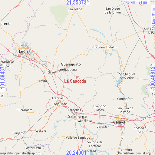
La Sauceda GPS coordinates[2]
20° 53' 53.916" North, 101° 11' 28.464" West
| Map corner | latitude | longitude |
|---|---|---|
| Upper-left | 21.55373°, | -101.89437° |
| Center: | 20.89831°, | -101.19124° |
| Lower-right: | 20.24001°, | -100.48812° |
| Map W x H: | 146.1×146.1 km | = 90.8×90.8mi |
| max Lat: | 32.7° ⇑25.2% North |
| La Sauceda: | 20.89831° |
| min Lat: | ⇓74.8% South 14.53588° |
| min Long | La Sauceda | max Long |
| -117.105° | -101.19124° | -86.73105° |
| W 25.1%⇐ | ⇒74.9% E |
Elevation
Elevation of La Sauceda is 1939 m = 6362 ft, and this is 685.3 m = 2248 ft above average elevation for this country.
| Max E: |
3497 m = 11473 ft | 29.3% |
| La Sauceda | 1939 m 6362 ft | |
| Avg. | 1253.7 m = 4113 ft | |
Min E: |
-1 m = -3 ft | 70.7% |
See also: Mexico elevation on elevation.city.
Geographical zone
La Sauceda is located in North Torrid zone (between Equator and Tropic of Cancer). Distance of this Northern Tropic circle is 282.2 km =175.4 mi to North.| Distance of | km | miles | from La Sauceda |
|---|---|---|---|
| North Pole | 7683.4 | 4774.2 | to North |
| Arctic Circle | 5077.5 | 3155 | to North |
| Tropic Cancer | 282.2 | 175.4 | to North |
| Equator | 2323.7 | 1443.9 | to South |


Nearby cities:
15 places around La Sauceda: (largest is in red/bold)
• Cajones
8 km =5 mi,  278°
278°
• Calderones
10.8 km =6.7 mi,  340°
340°
• Campuzano
5.6 km =3.5 mi,  69°
69°
• Coyote
7.1 km =4.4 mi,  232°
232°
• Cuevas
11 km =6.8 mi,  286°
286°
• El Maluco
11 km =6.8 mi, 292°
• El Tejabán
4.2 km =2.6 mi,  257°
257°
• Fraccionamiento Arboledas
11.1 km =6.9 mi,  304°
304°
• La Presita
9.3 km =5.8 mi, 292°
• La Trinidad
6.7 km =4.2 mi, 281°
• Puentecillas
9.8 km =6.1 mi, 292°
• San Isidro
10.2 km =6.3 mi,  306°
306°
• San José del Rodeo
3.6 km =2.2 mi, 313°
• Yerbabuena
11.3 km =7 mi, 309°
• Zangarro (Zangarro Nuevo)
9.6 km =6 mi,  242°
242°
Sources, notices
• [Note1] Compared only with cities in Mexico existing in our database
• [Src1] Map data: © OpenStreetMap contributors (CC-BY-SA)
• [Src2] Other city data from geonames.org with taken over terms of usage.
• [Src3] Geographical zone / Annual Mean Temperature by Robert A. Rohde @ Wikipedia
