La Ladera geodata
La Ladera (Michoacán) is a populated place; located in Mexico in America/Mexico_City (GMT-6) time zone. With population of 797 people, there are 10940 cities with bigger population in this country. Compared to other cities in Mexico, 56.9% of cities are located further ↓South; 81.9% of cities are located further →East and 56.2% of cities have lower elevation than La Ladera. Note1


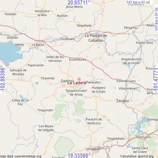
La Ladera GPS coordinates[2]
19° 59' 52.008" North, 102° 10' 50.988" West
| Map corner | latitude | longitude |
|---|---|---|
| Upper-left | 20.65711°, | -102.88396° |
| Center: | 19.99778°, | -102.18083° |
| Lower-right: | 19.33568°, | -101.47771° |
| Map W x H: | 146.9×146.9 km | = 91.3×91.3mi |
| max Lat: | 32.7° ⇑43.1% North |
| La Ladera: | 19.99778° |
| min Lat: | ⇓56.9% South 14.53588° |
| min Long | La Ladera | max Long |
| -117.105° | -102.18083° | -86.73105° |
| W 18.1%⇐ | ⇒81.9% E |
Elevation
Elevation of La Ladera is 1625 m = 5331 ft, and this is 371.3 m = 1218 ft above average elevation for this country.
| Max E: |
3497 m = 11473 ft | 43.8% |
| La Ladera | 1625 m 5331 ft | |
| Avg. | 1253.7 m = 4113 ft | |
Min E: |
-1 m = -3 ft | 56.2% |
See also: Mexico elevation on elevation.city.
Geographical zone
La Ladera is located in North Torrid zone (between Equator and Tropic of Cancer). Distance of this Northern Tropic circle is 382.4 km =237.6 mi to North.| Distance of | km | miles | from La Ladera |
|---|---|---|---|
| North Pole | 7783.5 | 4836.4 | to North |
| Arctic Circle | 5177.6 | 3217.2 | to North |
| Tropic Cancer | 382.4 | 237.6 | to North |
| Equator | 2223.5 | 1381.6 | to South |


Nearby cities:
15 places around La Ladera: (largest is in red/bold)
• Aquiles Serdán
3.7 km =2.3 mi,  279°
279°
• Atacheo de Regalado
6.8 km =4.2 mi,  354°
354°
• Atecucario de la Constitución (Atecuario)
9.6 km =6 mi,  320°
320°
• Canindo
9.2 km =5.7 mi,  225°
225°
• Chaparaco
9.3 km =5.8 mi,  243°
243°
• Colonia Linda Vista
6.8 km =4.2 mi,  261°
261°
• Colonia Primero de Mayo (La Beatilla)
6.6 km =4.1 mi,  253°
253°
• Fraccionamiento Ex-Hacienda el Refugio
9.5 km =5.9 mi, 236°
• Fraccionamiento Monte Olivo
7.5 km =4.7 mi, 258°
• Gómez Farías
8.8 km =5.5 mi,  163°
163°
• La Estancia de Amezcua
6.8 km =4.2 mi, 279°
• Ojo de Agua
1.8 km =1.1 mi, 262°
• Romero de Guzmán
8.9 km =5.5 mi,  293°
293°
• Romero de Torres
8.1 km =5 mi, 291°
• Tierras Blancas
6 km =3.7 mi, 159°
Sources, notices
• [Note1] Compared only with cities in Mexico existing in our database
• [Src1] Map data: © OpenStreetMap contributors (CC-BY-SA)
• [Src2] Other city data from geonames.org with taken over terms of usage.
• [Src3] Geographical zone / Annual Mean Temperature by Robert A. Rohde @ Wikipedia
