Gómez Farías geodata
Gómez Farías (State of Mexico) is a populated place; located in Mexico in America/Mexico_City (GMT-6) time zone. With population of 893 people, there are 9770 cities with bigger population in this country. Compared to other cities in Mexico, 55.5% of cities are located further ↓South; 81.8% of cities are located further →East and 59.6% of cities have lower elevation than Gómez Farías. Note1


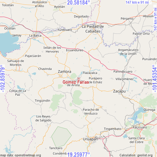
Gómez Farías GPS coordinates[2]
19° 55' 19.884" North, 102° 9' 23.976" West
| Map corner | latitude | longitude |
|---|---|---|
| Upper-left | 20.58184°, | -102.85979° |
| Center: | 19.92219°, | -102.15666° |
| Lower-right: | 19.25977°, | -101.45354° |
| Map W x H: | 147×147 km | = 91.3×91.3mi |
| max Lat: | 32.7° ⇑44.5% North |
| Gómez Farías: | 19.92219° |
| min Lat: | ⇓55.5% South 14.53588° |
| min Long | Gómez Farías | max Long |
| -117.105° | -102.15666° | -86.73105° |
| W 18.2%⇐ | ⇒81.8% E |
Elevation
Elevation of Gómez Farías is 1720 m = 5643 ft, and this is 466.3 m = 1530 ft above average elevation for this country.
| Max E: |
3497 m = 11473 ft | 40.4% |
| Gómez Farías | 1720 m 5643 ft | |
| Avg. | 1253.7 m = 4113 ft | |
Min E: |
-1 m = -3 ft | 59.6% |
See also: Mexico elevation on elevation.city.
Geographical zone
Gómez Farías is located in North Torrid zone (between Equator and Tropic of Cancer). Distance of this Northern Tropic circle is 390.8 km =242.8 mi to North.| Distance of | km | miles | from Gómez Farías |
|---|---|---|---|
| North Pole | 7791.9 | 4841.7 | to North |
| Arctic Circle | 5186 | 3222.4 | to North |
| Tropic Cancer | 390.8 | 242.8 | to North |
| Equator | 2215.1 | 1376.4 | to South |


Nearby cities:
15 places around Gómez Farías: (largest is in red/bold)
• Acachuén
10.7 km =6.6 mi,  141°
141°
• Canindo
9.3 km =5.8 mi,  282°
282°
• Chilchota
9.4 km =5.8 mi,  153°
153°
• Colonia Primero de Mayo (La Beatilla)
11 km =6.8 mi,  306°
306°
• Colonia las Malvinas (Colonia Antorcha)
8.7 km =5.4 mi,  236°
236°
• Etúcuaro
4.3 km =2.7 mi, 138°
• Fraccionamiento Ex-Hacienda el Refugio
10.9 km =6.8 mi,  286°
286°
• La Ladera
8.8 km =5.5 mi,  343°
343°
• Los Nogales
7.2 km =4.5 mi,  179°
179°
• Ojo de Agua
9.2 km =5.7 mi,  332°
332°
• Tanaquillo
10.5 km =6.5 mi, 144°
• Tangancícuaro de Arista
6.5 km =4 mi,  233°
233°
• Tierras Blancas
2.8 km =1.7 mi,  352°
352°
• Urén
10.1 km =6.3 mi, 147°
• Valle de Guadalupe
2.5 km =1.6 mi,  121°
121°
Sources, notices
• [Note1] Compared only with cities in Mexico existing in our database
• [Src1] Map data: © OpenStreetMap contributors (CC-BY-SA)
• [Src2] Other city data from geonames.org with taken over terms of usage.
• [Src3] Geographical zone / Annual Mean Temperature by Robert A. Rohde @ Wikipedia
