José Isabel Robles geodata
José Isabel Robles (Durango) is a populated place; located in Mexico in America/Monterrey (GMT-6) time zone. With population of 738 people, there are 11838 cities with bigger population in this country. Compared to other cities in Mexico, 91.1% of cities are located further ↓South; 87.1% of cities are located further →East and 55.8% of cities have lower elevation than José Isabel Robles. Note1


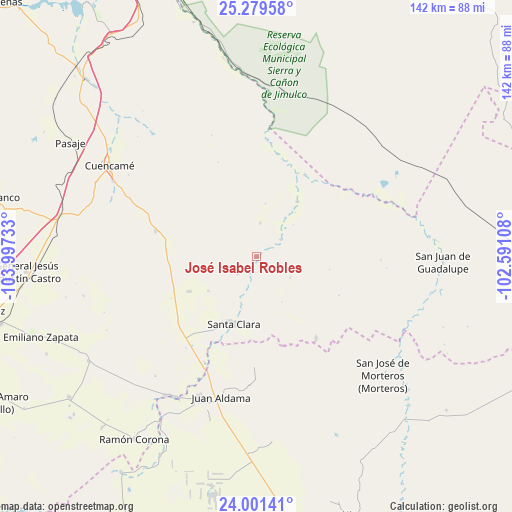
José Isabel Robles GPS coordinates[2]
24° 38' 31.668" North, 103° 17' 39.12" West
| Map corner | latitude | longitude |
|---|---|---|
| Upper-left | 25.27958°, | -103.99733° |
| Center: | 24.64213°, | -103.2942° |
| Lower-right: | 24.00141°, | -102.59108° |
| Map W x H: | 142.1×142.1 km | = 88.3×88.3mi |
| max Lat: | 32.7° ⇑8.9% North |
| José Isabel Robles: | 24.64213° |
| min Lat: | ⇓91.1% South 14.53588° |
| min Long | José Isabel Ro | max Long |
| -117.105° | -103.2942° | -86.73105° |
| W 12.9%⇐ | ⇒87.1% E |
Elevation
Elevation of José Isabel Robles is 1614 m = 5295 ft, and this is 360.3 m = 1182 ft above average elevation for this country.
| Max E: |
3497 m = 11473 ft | 44.2% |
| José Isabel Robles | 1614 m 5295 ft | |
| Avg. | 1253.7 m = 4113 ft | |
Min E: |
-1 m = -3 ft | 55.8% |
See also: Mexico elevation on elevation.city.
Geographical zone
José Isabel Robles is located in North temperate zone (between Tropic of Cancer and the Arctic Circle). Distance of this Northern Tropic circle is 134 km =83.3 mi to South.| Distance of | km | miles | from José Isabel Robles |
|---|---|---|---|
| North Pole | 7267.1 | 4515.6 | to North |
| Arctic Circle | 4661.2 | 2896.3 | to North |
| Tropic Cancer | 134 | 83.3 | to South |
| Equator | 2739.9 | 1702.5 | to South |


Nearby cities:
15 places around José Isabel Robles: (largest is in red/bold)
• 12 de Diciembre (Sombreretillo)
29.2 km =18.1 mi,  284°
284°
• Cuencamé de Ceniceros
48 km =29.8 mi,  302°
302°
• Diez de Abril
21 km =13 mi,  243°
243°
• General Juan José Ríos
37 km =23 mi,  197°
197°
• General Simón Bolívar
8.6 km =5.3 mi,  53°
53°
• Juan Aldama
40.2 km =25 mi,  194°
194°
• Miguel Auza
41.8 km =26 mi, 202°
• Ojitos
37.3 km =23.2 mi, 188°
• Oriente Aguanaval
29.3 km =18.2 mi,  11°
11°
• Pueblo de Santiago
46.7 km =29 mi, 302°
• San Antonio de la Laguna
32.6 km =20.3 mi,  206°
206°
• San Jose de Reyes
27.9 km =17.3 mi,  143°
143°
• San Marcos
46.1 km =28.6 mi, 213°
• Santa Clara
19.6 km =12.2 mi, 198°
• Villa Cardenas
43.5 km =27 mi,  153°
153°
Sources, notices
• [Note1] Compared only with cities in Mexico existing in our database
• [Src1] Map data: © OpenStreetMap contributors (CC-BY-SA)
• [Src2] Other city data from geonames.org with taken over terms of usage.
• [Src3] Geographical zone / Annual Mean Temperature by Robert A. Rohde @ Wikipedia
