Indaparapeo geodata
Indaparapeo (Michoacán) is a seat of a second-order administrative division; located in Mexico in America/Mexico_City (GMT-6) time zone. With population of 6,791 people, there are 1374 cities with bigger population in this country. Compared to other cities in Mexico, 52.5% of cities are located further ↓South; 73.2% of cities are located further →East and 70.3% of cities have lower elevation than Indaparapeo. Note1


Indaparapeo GPS coordinates[2]
19° 47' 15.612" North, 100° 58' 8.652" West
| Map corner | latitude | longitude |
|---|---|---|
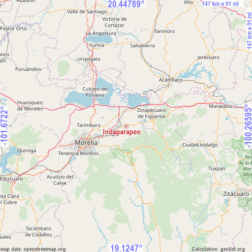
| Upper-left | 20.44789°, | -101.6722° |
| Center: | 19.78767°, | -100.96907° |
| Lower-right: | 19.1247°, | -100.26595° |
| Map W x H: | 147.1×147.1 km | = 91.4×91.4mi |
| max Lat: | 32.7° ⇑47.5% North |
| Indaparapeo: | 19.78767° |
| min Lat: | ⇓52.5% South 14.53588° |
| min Long | Indaparapeo | max Long |
| -117.105° | -100.96907° | -86.73105° |
| W 26.8%⇐ | ⇒73.2% E |
Elevation
Elevation of Indaparapeo is 1930 m = 6332 ft, and this is 676.3 m = 2219 ft above average elevation for this country.
| Max E: |
3497 m = 11473 ft | 29.7% |
| Indaparapeo | 1930 m 6332 ft | |
| Avg. | 1253.7 m = 4113 ft | |
Min E: |
-1 m = -3 ft | 70.3% |
See also: Mexico elevation on elevation.city.
Geographical zone
Indaparapeo is located in North Torrid zone (between Equator and Tropic of Cancer). Distance of this Northern Tropic circle is 405.7 km =252.1 mi to North.| Distance of | km | miles | from Indaparapeo |
|---|---|---|---|
| North Pole | 7806.9 | 4851 | to North |
| Arctic Circle | 5201 | 3231.8 | to North |
| Tropic Cancer | 405.7 | 252.1 | to North |
| Equator | 2200.2 | 1367.1 | to South |


Nearby cities:
15 places around Indaparapeo: (largest is in red/bold)
• Belisario Domínguez
9.3 km =5.8 mi,  358°
358°
• Charo
9.1 km =5.7 mi,  242°
242°
• Colonia Benito Juárez (Chapitiro)
7.8 km =4.8 mi,  352°
352°
• Colonia de Guadalupe
5.8 km =3.6 mi,  75°
75°
• Colonia del Triunfo (La Tepacua)
3.4 km =2.1 mi, 352°
• El Calvario
9.2 km =5.7 mi,  278°
278°
• El Castillo
10.5 km =6.5 mi,  90°
90°
• Francisco Villa
10.3 km =6.4 mi,  19°
19°
• Plan de las Palmas
4.9 km =3 mi,  331°
331°
• Queréndaro
8.6 km =5.3 mi,  73°
73°
• San Antonio Corrales (Nuevo Coronillas)
8.1 km =5 mi,  259°
259°
• San Lucas Pío
4.7 km =2.9 mi, 81°
• Tzintzimeo
9.2 km =5.7 mi, 354°
• Zurumbeneo
10.7 km =6.6 mi,  204°
204°
• Álvaro Obregón
8.3 km =5.2 mi,  296°
296°
Sources, notices
• [Note1] Compared only with cities in Mexico existing in our database
• [Src1] Map data: © OpenStreetMap contributors (CC-BY-SA)
• [Src2] Other city data from geonames.org with taken over terms of usage.
• [Src3] Geographical zone / Annual Mean Temperature by Robert A. Rohde @ Wikipedia
