General Pánfilo Natera geodata
General Pánfilo Natera (Zacatecas) is a seat of a second-order administrative division; located in Mexico in America/Mexico_City (GMT-6) time zone. With population of 4,599 people, there are 2001 cities with bigger population in this country. Compared to other cities in Mexico, 87.3% of cities are located further ↓South; 81.6% of cities are located further →East and 78.7% of cities have lower elevation than General Pánfilo Natera. Note1
Current local time in General Pánfilo Natera:
06:46 AM, WednesdayDifference from your time zone: hours


General Pánfilo Natera GPS coordinates[2]
22° 39' 52.596" North, 102° 6' 36.252" West
| Map corner | latitude | longitude |
|---|---|---|
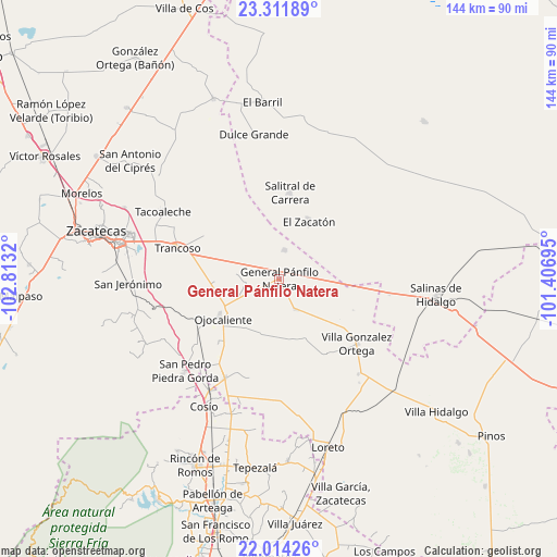
| Upper-left | 23.31189°, | -102.8132° |
| Center: | 22.66461°, | -102.11007° |
| Lower-right: | 22.01426°, | -101.40695° |
| Map W x H: | 144.3×144.3 km | = 89.7×89.7mi |
| max Lat: | 32.7° ⇑12.7% North |
| General Pánfilo Natera: | 22.66461° |
| min Lat: | ⇓87.3% South 14.53588° |
| min Long | General Pánfil | max Long |
| -117.105° | -102.11007° | -86.73105° |
| W 18.4%⇐ | ⇒81.6% E |
Elevation
Elevation of General Pánfilo Natera is 2105 m = 6906 ft, and this is 851.3 m = 2793 ft above average elevation for this country.
| Max E: |
3497 m = 11473 ft | 21.3% |
| General Pánfilo Natera | 2105 m 6906 ft | |
| Avg. | 1253.7 m = 4113 ft | |
Min E: |
-1 m = -3 ft | 78.7% |
See also: Mexico elevation on elevation.city.
Geographical zone
General Pánfilo Natera is located in North Torrid zone (between Equator and Tropic of Cancer). Distance of this Northern Tropic circle is 85.9 km =53.4 mi to North.| Distance of | km | miles | from General Pánfilo Natera |
|---|---|---|---|
| North Pole | 7487 | 4652.2 | to North |
| Arctic Circle | 4881.1 | 3033 | to North |
| Tropic Cancer | 85.9 | 53.4 | to North |
| Equator | 2520.1 | 1565.9 | to South |


Nearby cities:
15 places around General Pánfilo Natera: (largest is in red/bold)
• Bajío de San Nicolás
15.3 km =9.5 mi,  136°
136°
• El Nuevo Mundo
12.4 km =7.7 mi,  308°
308°
• El Saucito (El Horno)
7.5 km =4.7 mi,  11°
11°
• El Tule
7.8 km =4.8 mi,  109°
109°
• Guanajuatillo
6.7 km =4.2 mi,  329°
329°
• La Capilla
13.3 km =8.3 mi,  280°
280°
• La Tesorera
3.7 km =2.3 mi,  349°
349°
• Noria del Cerro de Santiago (El Cerro)
10.9 km =6.8 mi,  358°
358°
• Pozo de Jarillas
9.1 km =5.7 mi,  261°
261°
• Rancho Nuevo
6.2 km =3.9 mi,  186°
186°
• San Cristóbal
15.1 km =9.4 mi,  237°
237°
• San José el Saladillo (El Saladillo)
7.8 km =4.8 mi,  73°
73°
• San Pablo
11.7 km =7.3 mi,  174°
174°
• San Ramón
3.8 km =2.4 mi,  222°
222°
• Santa Elena
9 km =5.6 mi,  153°
153°
Sources, notices
• [Note1] Compared only with cities in Mexico existing in our database
• [Src1] Map data: © OpenStreetMap contributors (CC-BY-SA)
• [Src2] Other city data from geonames.org with taken over terms of usage.
• [Src3] Geographical zone / Annual Mean Temperature by Robert A. Rohde @ Wikipedia
