Rincón de Cucharatepec geodata
Rincón de Cucharatepec (Guerrero) is a populated place; located in Mexico in America/Mexico_City (GMT-6) time zone. With population of 807 people, there are 10824 cities with bigger population in this country. Compared to other cities in Mexico, 78.2% of cities are located further ↑North; 80.1% of cities are located further →East and 77.6% of cities have higher elevation than Rincón de Cucharatepec. Note1
Current local time in Rincón de Cucharatepec:
06:51 AM, WednesdayDifference from your time zone: hours


Rincón de Cucharatepec GPS coordinates[2]
18° 2' 43.836" North, 101° 52' 4.404" West
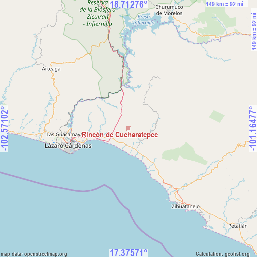
| Map corner | latitude | longitude |
|---|---|---|
| Upper-left | 18.71276°, | -102.57102° |
| Center: | 18.04551°, | -101.86789° |
| Lower-right: | 17.37571°, | -101.16477° |
| Map W x H: | 148.7×148.7 km | = 92.4×92.4mi |
| max Lat: | 32.7° ⇑78.2% North |
| Rincón de Cucharatepec: | 18.04551° |
| min Lat: | ⇓21.8% South 14.53588° |
| min Long | Rincón de Cuch | max Long |
| -117.105° | -101.86789° | -86.73105° |
| W 19.9%⇐ | ⇒80.1% E |
Elevation
Elevation of Rincón de Cucharatepec is 140 m = 459 ft, and this is 1113.7 m = 3654 ft below average elevation for this country.
| Max E: |
3497 m = 11473 ft | 77.6% |
| Avg. | 1253.7 m = 4113 ft | |
| Rincón de Cucharatepec | 140 m = 459 ft | |
Min E: |
-1 m = -3 ft | 22.4% |
See also: Mexico elevation on elevation.city.
Geographical zone
Rincón de Cucharatepec is located in North Torrid zone (between Equator and Tropic of Cancer). Distance of this Northern Tropic circle is 599.4 km =372.4 mi to North.| Distance of | km | miles | from Rincón de Cucharatepec |
|---|---|---|---|
| North Pole | 8000.6 | 4971.3 | to North |
| Arctic Circle | 5394.7 | 3352.1 | to North |
| Tropic Cancer | 599.4 | 372.4 | to North |
| Equator | 2006.5 | 1246.8 | to South |


Nearby cities:
15 places around Rincón de Cucharatepec: (largest is in red/bold)
• Coahuayutla de Guerrero
33 km =20.5 mi,  25°
25°
• El Naranjito
31.3 km =19.4 mi,  258°
258°
• Feliciano
11.6 km =7.2 mi,  253°
253°
• Guacamayas
36.5 km =22.7 mi,  265°
265°
• Infiernillo (Morelos de Infiernillo)
26.6 km =16.5 mi,  352°
352°
• Joluta
9.3 km =5.8 mi,  221°
221°
• La Unión
9.3 km =5.8 mi,  135°
135°
• Lagunillas
29.7 km =18.5 mi,  145°
145°
• Los Llanos de Temalhuacán (Los Llanos)
24.4 km =15.2 mi, 144°
• Petacalco
26.4 km =16.4 mi, 254°
• San Francisco
28.8 km =17.9 mi, 254°
• Surcua
22.8 km =14.2 mi, 259°
• Tamacuas (El Ranchito)
32.9 km =20.4 mi, 267°
• Troncones
33.5 km =20.8 mi, 152°
• Zacatula
33.2 km =20.6 mi, 263°
Sources, notices
• [Note1] Compared only with cities in Mexico existing in our database
• [Src1] Map data: © OpenStreetMap contributors (CC-BY-SA)
• [Src2] Other city data from geonames.org with taken over terms of usage.
• [Src3] Geographical zone / Annual Mean Temperature by Robert A. Rohde @ Wikipedia
