El Refugio geodata
El Refugio (Coahuila) is a populated place; located in Mexico in America/Monterrey (GMT-6) time zone. With population of 888 people, there are 9821 cities with bigger population in this country. Compared to other cities in Mexico, 92.5% of cities are located further ↓South; 86.4% of cities are located further →East and 57% of cities have higher elevation than El Refugio. Note1


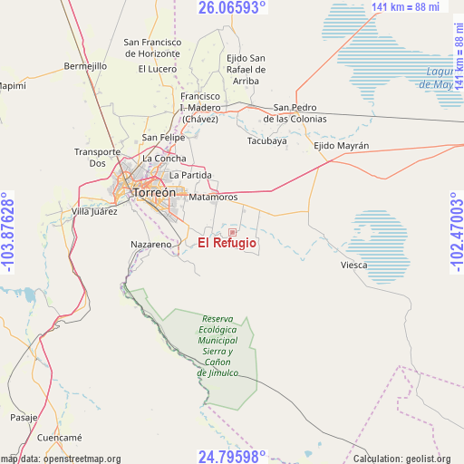
El Refugio GPS coordinates[2]
25° 25' 57.468" North, 103° 10' 23.34" West
| Map corner | latitude | longitude |
|---|---|---|
| Upper-left | 26.06593°, | -103.87628° |
| Center: | 25.43263°, | -103.17315° |
| Lower-right: | 24.79598°, | -102.47003° |
| Map W x H: | 141.2×141.2 km | = 87.7×87.7mi |
| max Lat: | 32.7° ⇑7.5% North |
| El Refugio: | 25.43263° |
| min Lat: | ⇓92.5% South 14.53588° |
| min Long | El Refugio | max Long |
| -117.105° | -103.17315° | -86.73105° |
| W 13.6%⇐ | ⇒86.4% E |
Elevation
Elevation of El Refugio is 1122 m = 3681 ft, and this is 131.7 m = 432 ft below average elevation for this country.
| Max E: |
3497 m = 11473 ft | 57% |
| Avg. | 1253.7 m = 4113 ft | |
| El Refugio | 1122 m = 3681 ft | |
Min E: |
-1 m = -3 ft | 43% |
See also: Mexico elevation on elevation.city.
Geographical zone
El Refugio is located in North temperate zone (between Tropic of Cancer and the Arctic Circle). Distance of this Northern Tropic circle is 221.9 km =137.9 mi to South.| Distance of | km | miles | from El Refugio |
|---|---|---|---|
| North Pole | 7179.2 | 4460.9 | to North |
| Arctic Circle | 4573.3 | 2841.7 | to North |
| Tropic Cancer | 221.9 | 137.9 | to South |
| Equator | 2827.8 | 1757.1 | to South |


Nearby cities:
15 places around El Refugio: (largest is in red/bold)
• Boquilla de las Perlas
16.4 km =10.2 mi,  224°
224°
• Gabino Vázquez (San Luis)
12.3 km =7.6 mi,  62°
62°
• Gilita
5.1 km =3.2 mi,  211°
211°
• Gregorio García (El Taconazo)
16.8 km =10.4 mi, 207°
• Hidalgo
7.1 km =4.4 mi,  26°
26°
• Ignacio Zaragoza
8.5 km =5.3 mi,  159°
159°
• La Rosita
6.3 km =3.9 mi,  249°
249°
• Las Mieleras
10.2 km =6.3 mi, 248°
• Matamoros
11.9 km =7.4 mi,  332°
332°
• Nuevo Mieleras
16.3 km =10.1 mi,  273°
273°
• Rancho Alegre
17.4 km =10.8 mi,  296°
296°
• San Pedro
4.4 km =2.7 mi, 271°
• Santo Niño Aguanaval
10.6 km =6.6 mi, 269°
• Tejabán de la Rosita
17.6 km =10.9 mi,  189°
189°
• Tejabán del Esfuerzo (El Esfuerzo)
17 km =10.6 mi,  202°
202°
Sources, notices
• [Note1] Compared only with cities in Mexico existing in our database
• [Src1] Map data: © OpenStreetMap contributors (CC-BY-SA)
• [Src2] Other city data from geonames.org with taken over terms of usage.
• [Src3] Geographical zone / Annual Mean Temperature by Robert A. Rohde @ Wikipedia
