Hidalgo geodata
Hidalgo (Coahuila) is a populated place; located in Mexico in America/Monterrey (GMT-6) time zone. With population of 4,143 people, there are 2211 cities with bigger population in this country. Compared to other cities in Mexico, 92.7% of cities are located further ↓South; 86.3% of cities are located further →East and 57.6% of cities have higher elevation than Hidalgo. Note1


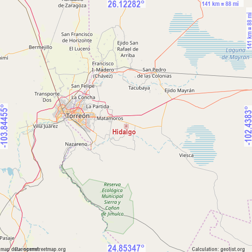
Hidalgo GPS coordinates[2]
25° 29' 23.352" North, 103° 8' 29.112" West
| Map corner | latitude | longitude |
|---|---|---|
| Upper-left | 26.12282°, | -103.84455° |
| Center: | 25.48982°, | -103.14142° |
| Lower-right: | 24.85347°, | -102.4383° |
| Map W x H: | 141.1×141.1 km | = 87.7×87.7mi |
| max Lat: | 32.7° ⇑7.3% North |
| Hidalgo: | 25.48982° |
| min Lat: | ⇓92.7% South 14.53588° |
| min Long | Hidalgo | max Long |
| -117.105° | -103.14142° | -86.73105° |
| W 13.7%⇐ | ⇒86.3% E |
Elevation
Elevation of Hidalgo is 1112 m = 3648 ft, and this is 141.7 m = 465 ft below average elevation for this country.
| Max E: |
3497 m = 11473 ft | 57.6% |
| Avg. | 1253.7 m = 4113 ft | |
| Hidalgo | 1112 m = 3648 ft | |
Min E: |
-1 m = -3 ft | 42.4% |
See also: Mexico elevation on elevation.city.
Geographical zone
Hidalgo is located in North temperate zone (between Tropic of Cancer and the Arctic Circle). Distance of this Northern Tropic circle is 228.3 km =141.9 mi to South.| Distance of | km | miles | from Hidalgo |
|---|---|---|---|
| North Pole | 7172.9 | 4457 | to North |
| Arctic Circle | 4567 | 2837.8 | to North |
| Tropic Cancer | 228.3 | 141.9 | to South |
| Equator | 2834.2 | 1761.1 | to South |


Nearby cities:
15 places around Hidalgo: (largest is in red/bold)
• Benito Juárez
14.1 km =8.8 mi,  319°
319°
• El Consuelo
16.3 km =10.1 mi,  303°
303°
• El Refugio
7.1 km =4.4 mi,  206°
206°
• Gabino Vázquez (San Luis)
7.8 km =4.8 mi,  95°
95°
• Gilita
12.2 km =7.6 mi, 208°
• Ignacio Zaragoza
14.3 km =8.9 mi,  180°
180°
• La Corona
15.9 km =9.9 mi,  311°
311°
• La Esperanza
16.4 km =10.2 mi, 301°
• La Partida
19.5 km =12.1 mi, 305°
• La Rosita
12.5 km =7.8 mi,  226°
226°
• Las Mieleras
16.2 km =10.1 mi, 231°
• Matamoros
9.7 km =6 mi, 295°
• Rancho Alegre
18.8 km =11.7 mi,  274°
274°
• San Pedro
9.8 km =6.1 mi, 230°
• Santo Niño Aguanaval
15.3 km =9.5 mi,  244°
244°
Sources, notices
• [Note1] Compared only with cities in Mexico existing in our database
• [Src1] Map data: © OpenStreetMap contributors (CC-BY-SA)
• [Src2] Other city data from geonames.org with taken over terms of usage.
• [Src3] Geographical zone / Annual Mean Temperature by Robert A. Rohde @ Wikipedia
