El Chayote geodata
El Chayote (Aguascalientes) is a populated place; located in Mexico in America/Mexico_City (GMT-6) time zone. With population of 1,817 people, there are 4791 cities with bigger population in this country. Compared to other cities in Mexico, 85.7% of cities are located further ↓South; 82.3% of cities are located further →East and 70.2% of cities have lower elevation than El Chayote. Note1


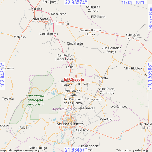
El Chayote GPS coordinates[2]
22° 17' 12.012" North, 102° 14' 20.4" West
| Map corner | latitude | longitude |
|---|---|---|
| Upper-left | 22.93574°, | -102.94213° |
| Center: | 22.28667°, | -102.239° |
| Lower-right: | 21.63457°, | -101.53588° |
| Map W x H: | 144.7×144.7 km | = 89.9×89.9mi |
| max Lat: | 32.7° ⇑14.3% North |
| El Chayote: | 22.28667° |
| min Lat: | ⇓85.7% South 14.53588° |
| min Long | El Chayote | max Long |
| -117.105° | -102.239° | -86.73105° |
| W 17.7%⇐ | ⇒82.3% E |
Elevation
Elevation of El Chayote is 1928 m = 6325 ft, and this is 674.3 m = 2212 ft above average elevation for this country.
| Max E: |
3497 m = 11473 ft | 29.8% |
| El Chayote | 1928 m 6325 ft | |
| Avg. | 1253.7 m = 4113 ft | |
Min E: |
-1 m = -3 ft | 70.2% |
See also: Mexico elevation on elevation.city.
Geographical zone
El Chayote is located in North Torrid zone (between Equator and Tropic of Cancer). Distance of this Northern Tropic circle is 127.9 km =79.5 mi to North.| Distance of | km | miles | from El Chayote |
|---|---|---|---|
| North Pole | 7529 | 4678.3 | to North |
| Arctic Circle | 4923.1 | 3059.1 | to North |
| Tropic Cancer | 127.9 | 79.5 | to North |
| Equator | 2478 | 1539.8 | to South |


Nearby cities:
15 places around El Chayote: (largest is in red/bold)
• California
1.3 km =0.8 mi,  263°
263°
• El Bajío
8.5 km =5.3 mi,  237°
237°
• El Porvenir
5.1 km =3.2 mi,  175°
175°
• El Refugio de Providencia (Providencia)
6.9 km =4.3 mi,  343°
343°
• El Saucillo
6.9 km =4.3 mi, 243°
• El Valle de las Delicias
4 km =2.5 mi,  32°
32°
• La Punta
6.9 km =4.3 mi,  307°
307°
• La Victoria
7.8 km =4.8 mi, 178°
• Los Alamitos
3.1 km =1.9 mi,  198°
198°
• Mar Negro
5.7 km =3.5 mi,  205°
205°
• Mesillas
7.9 km =4.9 mi,  66°
66°
• Ojo de Agua de los Montes
5 km =3.1 mi,  75°
75°
• Puerta del Muerto
1.5 km =0.9 mi,  317°
317°
• San Antonio
6.6 km =4.1 mi,  190°
190°
• San Jacinto
6.9 km =4.3 mi,  4°
4°
Sources, notices
• [Note1] Compared only with cities in Mexico existing in our database
• [Src1] Map data: © OpenStreetMap contributors (CC-BY-SA)
• [Src2] Other city data from geonames.org with taken over terms of usage.
• [Src3] Geographical zone / Annual Mean Temperature by Robert A. Rohde @ Wikipedia
