El Porvenir geodata
El Porvenir (Aguascalientes) is a populated place; located in Mexico in America/Mexico_City (GMT-6) time zone. With population of 588 people, there are 14598 cities with bigger population in this country. Compared to other cities in Mexico, 85.4% of cities are located further ↓South; 82.2% of cities are located further →East and 70.2% of cities have lower elevation than El Porvenir. Note1


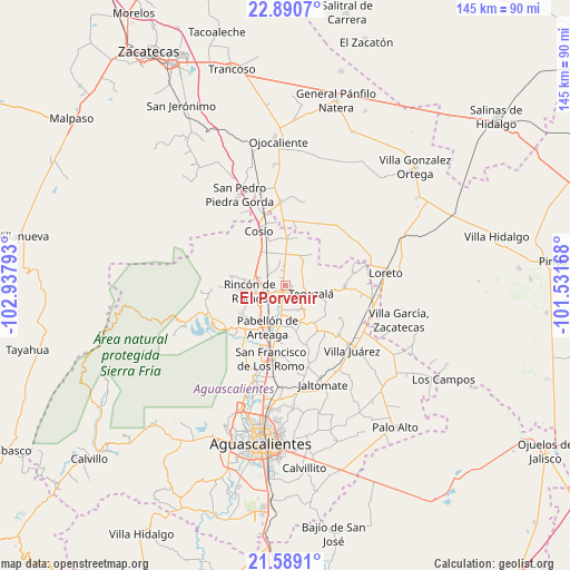
El Porvenir GPS coordinates[2]
22° 14' 29.076" North, 102° 14' 5.28" West
| Map corner | latitude | longitude |
|---|---|---|
| Upper-left | 22.8907°, | -102.93793° |
| Center: | 22.24141°, | -102.2348° |
| Lower-right: | 21.5891°, | -101.53168° |
| Map W x H: | 144.7×144.7 km | = 89.9×89.9mi |
| max Lat: | 32.7° ⇑14.6% North |
| El Porvenir: | 22.24141° |
| min Lat: | ⇓85.4% South 14.53588° |
| min Long | El Porvenir | max Long |
| -117.105° | -102.2348° | -86.73105° |
| W 17.8%⇐ | ⇒82.2% E |
Elevation
Elevation of El Porvenir is 1929 m = 6329 ft, and this is 675.3 m = 2216 ft above average elevation for this country.
| Max E: |
3497 m = 11473 ft | 29.8% |
| El Porvenir | 1929 m 6329 ft | |
| Avg. | 1253.7 m = 4113 ft | |
Min E: |
-1 m = -3 ft | 70.2% |
See also: Mexico elevation on elevation.city.
Geographical zone
El Porvenir is located in North Torrid zone (between Equator and Tropic of Cancer). Distance of this Northern Tropic circle is 132.9 km =82.6 mi to North.| Distance of | km | miles | from El Porvenir |
|---|---|---|---|
| North Pole | 7534 | 4681.4 | to North |
| Arctic Circle | 4928.2 | 3062.2 | to North |
| Tropic Cancer | 132.9 | 82.6 | to North |
| Equator | 2473 | 1536.7 | to South |


Nearby cities:
15 places around El Porvenir: (largest is in red/bold)
• California
5.2 km =3.2 mi,  340°
340°
• Carboneras
6.6 km =4.1 mi,  190°
190°
• El Bajío
7.6 km =4.7 mi,  273°
273°
• El Chayote
5.1 km =3.2 mi,  355°
355°
• El Gigante
3.9 km =2.4 mi,  203°
203°
• El Refugio
7.8 km =4.8 mi,  174°
174°
• El Saucillo
6.9 km =4.3 mi,  286°
286°
• El Valle de las Delicias
8.6 km =5.3 mi,  11°
11°
• La Victoria
2.8 km =1.7 mi,  184°
184°
• Los Alamitos
2.6 km =1.6 mi,  326°
326°
• Mar Negro
2.9 km =1.8 mi, 267°
• Ojo de Agua de los Montes
7.7 km =4.8 mi,  35°
35°
• Puerta del Muerto
6.3 km =3.9 mi,  346°
346°
• San Antonio
2.2 km =1.4 mi,  227°
227°
• Tepezalá
7 km =4.3 mi,  106°
106°
Sources, notices
• [Note1] Compared only with cities in Mexico existing in our database
• [Src1] Map data: © OpenStreetMap contributors (CC-BY-SA)
• [Src2] Other city data from geonames.org with taken over terms of usage.
• [Src3] Geographical zone / Annual Mean Temperature by Robert A. Rohde @ Wikipedia
