El Aguacate geodata
El Aguacate (Jalisco) is a populated place; located in Mexico in America/Mexico_City (GMT-6) time zone. With population of 981 people, there are 8862 cities with bigger population in this country. Compared to other cities in Mexico, 60.5% of cities are located further ↑North; 91.3% of cities are located further →East and 90% of cities have higher elevation than El Aguacate. Note1


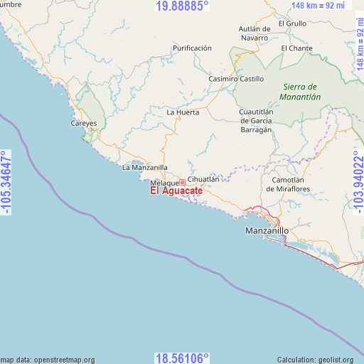
El Aguacate GPS coordinates[2]
19° 13' 34.68" North, 104° 38' 36.024" West
| Map corner | latitude | longitude |
|---|---|---|
| Upper-left | 19.88885°, | -105.34647° |
| Center: | 19.2263°, | -104.64334° |
| Lower-right: | 18.56106°, | -103.94022° |
| Map W x H: | 147.6×147.6 km | = 91.7×91.7mi |
| max Lat: | 32.7° ⇑60.5% North |
| El Aguacate: | 19.2263° |
| min Lat: | ⇓39.5% South 14.53588° |
| min Long | El Aguacate | max Long |
| -117.105° | -104.64334° | -86.73105° |
| W 8.7%⇐ | ⇒91.3% E |
Elevation
Elevation of El Aguacate is 24 m = 79 ft, and this is 1229.7 m = 4034 ft below average elevation for this country.
| Max E: |
3497 m = 11473 ft | 90% |
| Avg. | 1253.7 m = 4113 ft | |
| El Aguacate | 24 m = 79 ft | |
Min E: |
-1 m = -3 ft | 10% |
See also: Mexico elevation on elevation.city.
Geographical zone
El Aguacate is located in North Torrid zone (between Equator and Tropic of Cancer). Distance of this Northern Tropic circle is 468.2 km =290.9 mi to North.| Distance of | km | miles | from El Aguacate |
|---|---|---|---|
| North Pole | 7869.3 | 4889.8 | to North |
| Arctic Circle | 5263.4 | 3270.5 | to North |
| Tropic Cancer | 468.2 | 290.9 | to North |
| Equator | 2137.8 | 1328.4 | to South |


Nearby cities:
15 places around El Aguacate: (largest is in red/bold)
• Barra de Navidad
4.6 km =2.9 mi,  242°
242°
• Chavarín
9.3 km =5.8 mi,  106°
106°
• Cihuatlán
8.3 km =5.2 mi,  82°
82°
• Colonia Pinal Villa
5.5 km =3.4 mi,  283°
283°
• El Naranjo
25.9 km =16.1 mi, 114°
• El Rebalsito de Apazulco
27 km =16.8 mi,  289°
289°
• Emiliano Zapata (El Ranchito)
8.1 km =5 mi, 283°
• Jaluco
4.3 km =2.7 mi, 276°
• La Central
23.5 km =14.6 mi, 113°
• La Huerta
28.7 km =17.8 mi,  359°
359°
• La Manzanilla
16.3 km =10.1 mi, 291°
• Las Juntas
23.7 km =14.7 mi,  343°
343°
• Río Marabasco
12 km =7.5 mi,  87°
87°
• San Patricio
6.4 km =4 mi,  269°
269°
• Tequesquitlán
22.1 km =13.7 mi,  35°
35°
Sources, notices
• [Note1] Compared only with cities in Mexico existing in our database
• [Src1] Map data: © OpenStreetMap contributors (CC-BY-SA)
• [Src2] Other city data from geonames.org with taken over terms of usage.
• [Src3] Geographical zone / Annual Mean Temperature by Robert A. Rohde @ Wikipedia
