Las Juntas geodata
Las Juntas (Jalisco) is a populated place; located in Mexico in America/Mexico_City (GMT-6) time zone. With population of 6,259 people, there are 1489 cities with bigger population in this country. Compared to other cities in Mexico, 55.5% of cities are located further ↑North; 91.4% of cities are located further →East and 74.6% of cities have higher elevation than Las Juntas. Note1


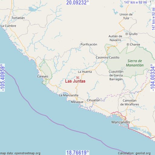
Las Juntas GPS coordinates[2]
19° 25' 50.196" North, 104° 42' 23.256" West
| Map corner | latitude | longitude |
|---|---|---|
| Upper-left | 20.09232°, | -105.40959° |
| Center: | 19.43061°, | -104.70646° |
| Lower-right: | 18.76619°, | -104.00334° |
| Map W x H: | 147.5×147.5 km | = 91.7×91.7mi |
| max Lat: | 32.7° ⇑55.5% North |
| Las Juntas: | 19.43061° |
| min Lat: | ⇓44.5% South 14.53588° |
| min Long | Las Juntas | max Long |
| -117.105° | -104.70646° | -86.73105° |
| W 8.6%⇐ | ⇒91.4% E |
Elevation
Elevation of Las Juntas is 233 m = 764 ft, and this is 1020.7 m = 3349 ft below average elevation for this country.
| Max E: |
3497 m = 11473 ft | 74.6% |
| Avg. | 1253.7 m = 4113 ft | |
| Las Juntas | 233 m = 764 ft | |
Min E: |
-1 m = -3 ft | 25.4% |
See also: Mexico elevation on elevation.city.
Geographical zone
Las Juntas is located in North Torrid zone (between Equator and Tropic of Cancer). Distance of this Northern Tropic circle is 445.4 km =276.8 mi to North.| Distance of | km | miles | from Las Juntas |
|---|---|---|---|
| North Pole | 7846.6 | 4875.6 | to North |
| Arctic Circle | 5240.7 | 3256.4 | to North |
| Tropic Cancer | 445.4 | 276.8 | to North |
| Equator | 2160.5 | 1342.5 | to South |


Nearby cities:
15 places around Las Juntas: (largest is in red/bold)
• Apazulco (Miguel Hidalgo Viejo)
19.3 km =12 mi,  249°
249°
• Barra de Navidad
25 km =15.5 mi,  174°
174°
• Cihuatlán
26.2 km =16.3 mi,  145°
145°
• Colonia Pinal Villa
21.5 km =13.4 mi,  176°
176°
• Coyamel (El Coyame)
20.6 km =12.8 mi,  68°
68°
• El Aguacate
23.7 km =14.7 mi,  163°
163°
• El Chico
21.5 km =13.4 mi,  46°
46°
• El Rebalsito de Apazulco
23.5 km =14.6 mi,  233°
233°
• Emiliano Zapata (El Ranchito)
20.8 km =12.9 mi, 183°
• Jaluco
22.4 km =13.9 mi, 174°
• La Huerta
8.9 km =5.5 mi, 47°
• La Manzanilla
18.7 km =11.6 mi,  207°
207°
• San Patricio
22.8 km =14.2 mi, 179°
• Tecomates
26.7 km =16.6 mi,  60°
60°
• Tequesquitlán
20.1 km =12.5 mi,  103°
103°
Sources, notices
• [Note1] Compared only with cities in Mexico existing in our database
• [Src1] Map data: © OpenStreetMap contributors (CC-BY-SA)
• [Src2] Other city data from geonames.org with taken over terms of usage.
• [Src3] Geographical zone / Annual Mean Temperature by Robert A. Rohde @ Wikipedia
