Copándaro de Galeana geodata
Copándaro de Galeana (Michoacán) is a seat of a second-order administrative division; located in Mexico in America/Mexico_City (GMT-6) time zone. With population of 3,112 people, there are 2902 cities with bigger population in this country. Compared to other cities in Mexico, 54.9% of cities are located further ↓South; 75.1% of cities are located further →East and 65.9% of cities have lower elevation than Copándaro de Galeana. Note1
Current local time in Copándaro de Galeana:
06:50 AM, WednesdayDifference from your time zone: hours


Copándaro de Galeana GPS coordinates[2]
19° 53' 33.144" North, 101° 12' 50.184" West
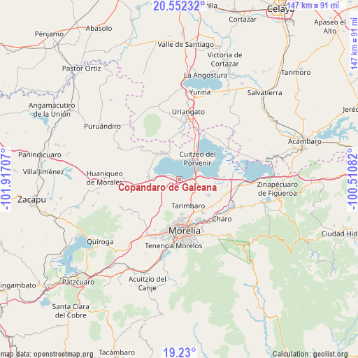
| Map corner | latitude | longitude |
|---|---|---|
| Upper-left | 20.55232°, | -101.91707° |
| Center: | 19.89254°, | -101.21394° |
| Lower-right: | 19.23°, | -100.51082° |
| Map W x H: | 147×147 km | = 91.3×91.3mi |
| max Lat: | 32.7° ⇑45.1% North |
| Copándaro de Galeana: | 19.89254° |
| min Lat: | ⇓54.9% South 14.53588° |
| min Long | Copándaro de G | max Long |
| -117.105° | -101.21394° | -86.73105° |
| W 24.9%⇐ | ⇒75.1% E |
Elevation
Elevation of Copándaro de Galeana is 1849 m = 6066 ft, and this is 595.3 m = 1953 ft above average elevation for this country.
| Max E: |
3497 m = 11473 ft | 34.1% |
| Copándaro de Galeana | 1849 m 6066 ft | |
| Avg. | 1253.7 m = 4113 ft | |
Min E: |
-1 m = -3 ft | 65.9% |
See also: Mexico elevation on elevation.city.
Geographical zone
Copándaro de Galeana is located in North Torrid zone (between Equator and Tropic of Cancer). Distance of this Northern Tropic circle is 394.1 km =244.9 mi to North.| Distance of | km | miles | from Copándaro de Galeana |
|---|---|---|---|
| North Pole | 7795.2 | 4843.7 | to North |
| Arctic Circle | 5189.3 | 3224.5 | to North |
| Tropic Cancer | 394.1 | 244.9 | to North |
| Equator | 2211.8 | 1374.3 | to South |


Nearby cities:
15 places around Copándaro de Galeana: (largest is in red/bold)
• Arumbaro
2.3 km =1.4 mi,  122°
122°
• Capacho
8.2 km =5.1 mi,  347°
347°
• Cañada de la Yerbabuena
2.9 km =1.8 mi,  167°
167°
• Cañada de los Sauces
6.7 km =4.2 mi,  181°
181°
• Cañada del Herrero
8.4 km =5.2 mi, 167°
• Cuto del Porvenir
7.8 km =4.8 mi,  108°
108°
• Doctor Miguel Silva (San Guillermo)
9.1 km =5.7 mi,  27°
27°
• El Nispo
1.3 km =0.8 mi,  244°
244°
• Jamaica
9.2 km =5.7 mi, 116°
• Jéruco
9.9 km =6.2 mi, 27°
• Mesón Nuevo (Cañada de la Magdalena)
10 km =6.2 mi,  149°
149°
• San Agustín del Maíz
5.2 km =3.2 mi,  81°
81°
• San Juan Benito Juárez (San Juan Tararameo)
9.3 km =5.8 mi,  73°
73°
• Santa Cruz
7.3 km =4.5 mi,  125°
125°
• Santa Rita
5.2 km =3.2 mi,  285°
285°
Sources, notices
• [Note1] Compared only with cities in Mexico existing in our database
• [Src1] Map data: © OpenStreetMap contributors (CC-BY-SA)
• [Src2] Other city data from geonames.org with taken over terms of usage.
• [Src3] Geographical zone / Annual Mean Temperature by Robert A. Rohde @ Wikipedia
