Cañada de los Sauces geodata
Cañada de los Sauces (Michoacán) is a populated place; located in Mexico in America/Mexico_City (GMT-6) time zone. With population of 813 people, there are 10742 cities with bigger population in this country. Compared to other cities in Mexico, 53.6% of cities are located further ↓South; 75.1% of cities are located further →East and 74.5% of cities have lower elevation than Cañada de los Sauces. Note1
Current local time in Cañada de los Sauces:
05:29 AM, WednesdayDifference from your time zone: hours


Cañada de los Sauces GPS coordinates[2]
19° 49' 54.984" North, 101° 12' 56.988" West
| Map corner | latitude | longitude |
|---|---|---|
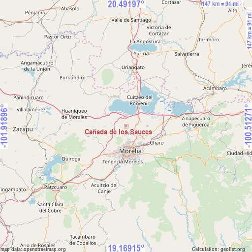
| Upper-left | 20.49197°, | -101.91896° |
| Center: | 19.83194°, | -101.21583° |
| Lower-right: | 19.16915°, | -100.51271° |
| Map W x H: | 147.1×147.1 km | = 91.4×91.4mi |
| max Lat: | 32.7° ⇑46.4% North |
| Cañada de los Sauces: | 19.83194° |
| min Lat: | ⇓53.6% South 14.53588° |
| min Long | Cañada de los | max Long |
| -117.105° | -101.21583° | -86.73105° |
| W 24.9%⇐ | ⇒75.1% E |
Elevation
Elevation of Cañada de los Sauces is 2022 m = 6634 ft, and this is 768.3 m = 2521 ft above average elevation for this country.
| Max E: |
3497 m = 11473 ft | 25.5% |
| Cañada de los Sauces | 2022 m 6634 ft | |
| Avg. | 1253.7 m = 4113 ft | |
Min E: |
-1 m = -3 ft | 74.5% |
See also: Mexico elevation on elevation.city.
Geographical zone
Cañada de los Sauces is located in North Torrid zone (between Equator and Tropic of Cancer). Distance of this Northern Tropic circle is 400.8 km =249 mi to North.| Distance of | km | miles | from Cañada de los Sauces |
|---|---|---|---|
| North Pole | 7802 | 4847.9 | to North |
| Arctic Circle | 5196.1 | 3228.7 | to North |
| Tropic Cancer | 400.8 | 249 | to North |
| Equator | 2205.1 | 1370.2 | to South |


Nearby cities:
15 places around Cañada de los Sauces: (largest is in red/bold)
• Arumbaro
5.9 km =3.7 mi,  21°
21°
• Cañada de la Yerbabuena
4 km =2.5 mi,  12°
12°
• Cañada del Herrero
2.5 km =1.6 mi,  125°
125°
• Chiquimitío
5.6 km =3.5 mi,  222°
222°
• Copándaro de Galeana
6.7 km =4.2 mi,  1°
1°
• El Colegio
7.7 km =4.8 mi,  148°
148°
• El Nispo
6.3 km =3.9 mi,  351°
351°
• Ex-Hacienda de Guadalupe
5.3 km =3.3 mi,  178°
178°
• Fraccionamiento Galaxia Tarímbaro
8.1 km =5 mi,  164°
164°
• Mesón Nuevo (Cañada de la Magdalena)
5.6 km =3.5 mi,  110°
110°
• Peña del Panal
7.1 km =4.4 mi, 157°
• Rancho Nuevo
5.1 km =3.2 mi,  170°
170°
• Santa Cruz
6.6 km =4.1 mi,  68°
68°
• Santa María
6.8 km =4.2 mi, 178°
• Tarímbaro
5.7 km =3.5 mi,  135°
135°
Sources, notices
• [Note1] Compared only with cities in Mexico existing in our database
• [Src1] Map data: © OpenStreetMap contributors (CC-BY-SA)
• [Src2] Other city data from geonames.org with taken over terms of usage.
• [Src3] Geographical zone / Annual Mean Temperature by Robert A. Rohde @ Wikipedia
