El Cerrito geodata
El Cerrito (San Luis Potosí) is a populated place; located in Mexico in America/Mexico_City (GMT-6) time zone. With population of 704 people, there are 12362 cities with bigger population in this country. Compared to other cities in Mexico, 82.8% of cities are located further ↓South; 71% of cities are located further →East and 62.6% of cities have lower elevation than El Cerrito. Note1


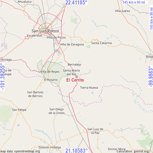
El Cerrito GPS coordinates[2]
21° 45' 37.188" North, 100° 41' 21.912" West
| Map corner | latitude | longitude |
|---|---|---|
| Upper-left | 22.41185°, | -101.39255° |
| Center: | 21.76033°, | -100.68942° |
| Lower-right: | 21.10583°, | -99.9863° |
| Map W x H: | 145.2×145.2 km | = 90.2×90.2mi |
| max Lat: | 32.7° ⇑17.2% North |
| El Cerrito: | 21.76033° |
| min Lat: | ⇓82.8% South 14.53588° |
| min Long | El Cerrito | max Long |
| -117.105° | -100.68942° | -86.73105° |
| W 29%⇐ | ⇒71% E |
Elevation
Elevation of El Cerrito is 1771 m = 5810 ft, and this is 517.3 m = 1697 ft above average elevation for this country.
| Max E: |
3497 m = 11473 ft | 37.4% |
| El Cerrito | 1771 m 5810 ft | |
| Avg. | 1253.7 m = 4113 ft | |
Min E: |
-1 m = -3 ft | 62.6% |
See also: Mexico elevation on elevation.city.
Geographical zone
El Cerrito is located in North Torrid zone (between Equator and Tropic of Cancer). Distance of this Northern Tropic circle is 186.4 km =115.8 mi to North.| Distance of | km | miles | from El Cerrito |
|---|---|---|---|
| North Pole | 7587.5 | 4714.7 | to North |
| Arctic Circle | 4981.7 | 3095.5 | to North |
| Tropic Cancer | 186.4 | 115.8 | to North |
| Equator | 2419.5 | 1503.4 | to South |


Nearby cities:
15 places around El Cerrito: (largest is in red/bold)
• Cañada de Yáñez
6.8 km =4.2 mi,  31°
31°
• Ejido la Pitahaya (Santo Domingo)
18.7 km =11.6 mi,  203°
203°
• El Fuerte
5.9 km =3.7 mi,  153°
153°
• Enramadas
16.7 km =10.4 mi,  325°
325°
• Estancia de Atotonilco
17.3 km =10.7 mi,  210°
210°
• Guanajuatito (Cerrito de la Cruz)
9.1 km =5.7 mi,  307°
307°
• La Barranca
7.9 km =4.9 mi,  295°
295°
• La Cardona
5.2 km =3.2 mi,  273°
273°
• Ojo Caliente
11.7 km =7.3 mi, 325°
• Santa María del Río
6.4 km =4 mi, 308°
• Sánchez
3.1 km =1.9 mi,  346°
346°
• Texas
21.2 km =13.2 mi,  344°
344°
• Tierra Nueva
15.7 km =9.8 mi,  130°
130°
• Villela
9.8 km =6.1 mi, 201°
• Yerbabuena
11.5 km =7.1 mi,  224°
224°
Sources, notices
• [Note1] Compared only with cities in Mexico existing in our database
• [Src1] Map data: © OpenStreetMap contributors (CC-BY-SA)
• [Src2] Other city data from geonames.org with taken over terms of usage.
• [Src3] Geographical zone / Annual Mean Temperature by Robert A. Rohde @ Wikipedia
