El Cazadero geodata
El Cazadero (Zacatecas) is a populated place; located in Mexico in America/Mexico_City (GMT-6) time zone. With population of 1,186 people, there are 7322 cities with bigger population in this country. Compared to other cities in Mexico, 89.2% of cities are located further ↓South; 86.2% of cities are located further →East and 70.7% of cities have lower elevation than El Cazadero. Note1


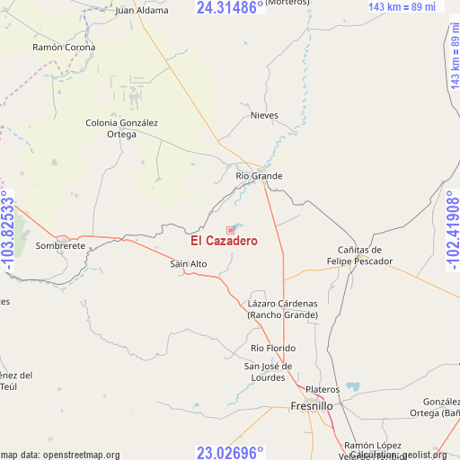
El Cazadero GPS coordinates[2]
23° 40' 21" North, 103° 7' 19.92" West
| Map corner | latitude | longitude |
|---|---|---|
| Upper-left | 24.31486°, | -103.82533° |
| Center: | 23.6725°, | -103.1222° |
| Lower-right: | 23.02696°, | -102.41908° |
| Map W x H: | 143.2×143.2 km | = 89×89mi |
| max Lat: | 32.7° ⇑10.8% North |
| El Cazadero: | 23.6725° |
| min Lat: | ⇓89.2% South 14.53588° |
| min Long | El Cazadero | max Long |
| -117.105° | -103.1222° | -86.73105° |
| W 13.8%⇐ | ⇒86.2% E |
Elevation
Elevation of El Cazadero is 1939 m = 6362 ft, and this is 685.3 m = 2248 ft above average elevation for this country.
| Max E: |
3497 m = 11473 ft | 29.3% |
| El Cazadero | 1939 m 6362 ft | |
| Avg. | 1253.7 m = 4113 ft | |
Min E: |
-1 m = -3 ft | 70.7% |
See also: Mexico elevation on elevation.city.
Geographical zone
El Cazadero is located in North temperate zone (between Tropic of Cancer and the Arctic Circle). Distance of this Northern Tropic circle is 26.2 km =16.3 mi to South.| Distance of | km | miles | from El Cazadero |
|---|---|---|---|
| North Pole | 7374.9 | 4582.5 | to North |
| Arctic Circle | 4769 | 2963.3 | to North |
| Tropic Cancer | 26.2 | 16.3 | to South |
| Equator | 2632.1 | 1635.5 | to South |


Nearby cities:
15 places around El Cazadero: (largest is in red/bold)
• Barrancas
9.5 km =5.9 mi,  241°
241°
• Cañas
14.7 km =9.1 mi,  302°
302°
• Ciénega y Mancilla
14.3 km =8.9 mi,  20°
20°
• Colonia Francisco García Salinas
16.5 km =10.3 mi,  338°
338°
• Emiliano Zapata
8.8 km =5.5 mi,  305°
305°
• Ignacio López Rayón (Los Delgado)
17 km =10.6 mi, 17°
• José María Morelos (Santa Mónica)
7.5 km =4.7 mi,  170°
170°
• La Florida
15.4 km =9.6 mi, 17°
• Las Piedras
15.6 km =9.7 mi, 22°
• Los Condes
19 km =11.8 mi,  13°
13°
• Pastelera
8.4 km =5.2 mi, 17°
• Sain Alto
16.4 km =10.2 mi,  231°
231°
• Sain Bajo
8.2 km =5.1 mi,  220°
220°
• San Felipe
13 km =8.1 mi, 6°
• Tierra Blanca
17.8 km =11.1 mi, 15°
Sources, notices
• [Note1] Compared only with cities in Mexico existing in our database
• [Src1] Map data: © OpenStreetMap contributors (CC-BY-SA)
• [Src2] Other city data from geonames.org with taken over terms of usage.
• [Src3] Geographical zone / Annual Mean Temperature by Robert A. Rohde @ Wikipedia
