Bermejillo geodata
Bermejillo (Durango) is a populated place; located in Mexico in America/Monterrey (GMT-6) time zone. With population of 9,149 people, there are 1028 cities with bigger population in this country. Compared to other cities in Mexico, 94.9% of cities are located further ↓South; 88.8% of cities are located further →East and 57% of cities have higher elevation than Bermejillo. Note1


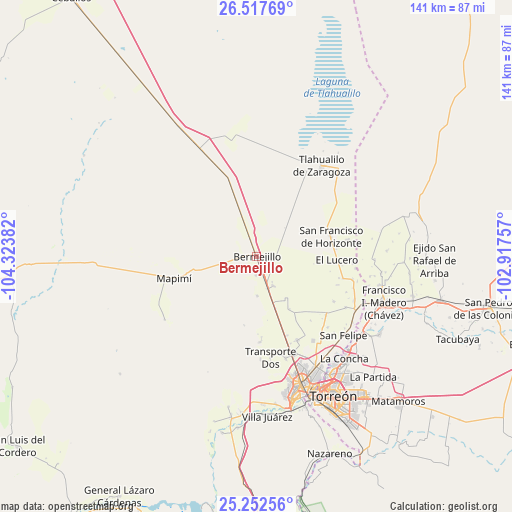
Bermejillo GPS coordinates[2]
25° 53' 12.552" North, 103° 37' 14.484" West
| Map corner | latitude | longitude |
|---|---|---|
| Upper-left | 26.51769°, | -104.32382° |
| Center: | 25.88682°, | -103.62069° |
| Lower-right: | 25.25256°, | -102.91757° |
| Map W x H: | 140.7×140.7 km | = 87.4×87.4mi |
| max Lat: | 32.7° ⇑5.1% North |
| Bermejillo: | 25.88682° |
| min Lat: | ⇓94.9% South 14.53588° |
| min Long | Bermejillo | max Long |
| -117.105° | -103.62069° | -86.73105° |
| W 11.2%⇐ | ⇒88.8% E |
Elevation
Elevation of Bermejillo is 1123 m = 3684 ft, and this is 130.7 m = 429 ft below average elevation for this country.
| Max E: |
3497 m = 11473 ft | 57% |
| Avg. | 1253.7 m = 4113 ft | |
| Bermejillo | 1123 m = 3684 ft | |
Min E: |
-1 m = -3 ft | 43% |
See also: Mexico elevation on elevation.city.
Geographical zone
Bermejillo is located in North temperate zone (between Tropic of Cancer and the Arctic Circle). Distance of this Northern Tropic circle is 272.4 km =169.3 mi to South.| Distance of | km | miles | from Bermejillo |
|---|---|---|---|
| North Pole | 7128.7 | 4429.6 | to North |
| Arctic Circle | 4522.8 | 2810.3 | to North |
| Tropic Cancer | 272.4 | 169.3 | to South |
| Equator | 2878.3 | 1788.5 | to South |


Nearby cities:
15 places around Bermejillo: (largest is in red/bold)
• Brittingham
15.2 km =9.4 mi,  160°
160°
• Dinamita
18.6 km =11.6 mi,  191°
191°
• Dolores
19.1 km =11.9 mi, 163°
• El Lucero
21.9 km =13.6 mi,  92°
92°
• Estación Noé
19.9 km =12.4 mi, 160°
• La Aurora
16.2 km =10.1 mi,  170°
170°
• La Luz
16.8 km =10.4 mi,  147°
147°
• Marta
10.7 km =6.6 mi,  179°
179°
• Palo Blanco
21.2 km =13.2 mi, 152°
• San Francisco de Horizonte (Horizonte)
21.1 km =13.1 mi,  74°
74°
• San José de Bellavista
9.5 km =5.9 mi,  258°
258°
• San Julio
20.7 km =12.9 mi, 74°
• Santa Clara
9.1 km =5.7 mi, 162°
• Seis de Octubre
9.4 km =5.8 mi, 149°
• Veintidós de Febrero
5.1 km =3.2 mi, 182°
Sources, notices
• [Note1] Compared only with cities in Mexico existing in our database
• [Src1] Map data: © OpenStreetMap contributors (CC-BY-SA)
• [Src2] Other city data from geonames.org with taken over terms of usage.
• [Src3] Geographical zone / Annual Mean Temperature by Robert A. Rohde @ Wikipedia
