San José de Bellavista geodata
San José de Bellavista (Durango) is a populated place; located in Mexico in America/Monterrey (GMT-6) time zone. With population of 607 people, there are 14186 cities with bigger population in this country. Compared to other cities in Mexico, 94.7% of cities are located further ↓South; 89.1% of cities are located further →East and 55.9% of cities have higher elevation than San José de Bellavista. Note1


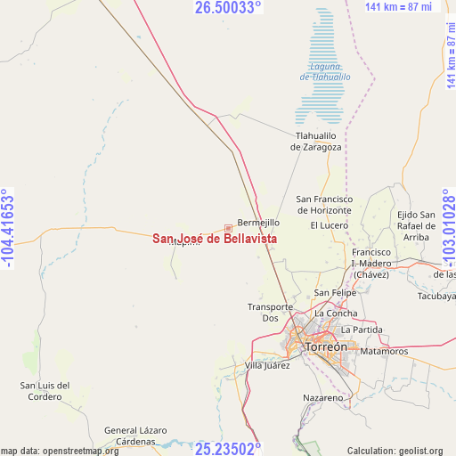
San José de Bellavista GPS coordinates[2]
25° 52' 9.732" North, 103° 42' 48.24" West
| Map corner | latitude | longitude |
|---|---|---|
| Upper-left | 26.50033°, | -104.41653° |
| Center: | 25.86937°, | -103.7134° |
| Lower-right: | 25.23502°, | -103.01028° |
| Map W x H: | 140.7×140.7 km | = 87.4×87.4mi |
| max Lat: | 32.7° ⇑5.3% North |
| San José de Bellavista: | 25.86937° |
| min Lat: | ⇓94.7% South 14.53588° |
| min Long | San José de Be | max Long |
| -117.105° | -103.7134° | -86.73105° |
| W 10.9%⇐ | ⇒89.1% E |
Elevation
Elevation of San José de Bellavista is 1164 m = 3819 ft, and this is 89.7 m = 294 ft below average elevation for this country.
| Max E: |
3497 m = 11473 ft | 55.9% |
| Avg. | 1253.7 m = 4113 ft | |
| San José de Bellavista | 1164 m = 3819 ft | |
Min E: |
-1 m = -3 ft | 44.1% |
See also: Mexico elevation on elevation.city.
Geographical zone
San José de Bellavista is located in North temperate zone (between Tropic of Cancer and the Arctic Circle). Distance of this Northern Tropic circle is 270.5 km =168.1 mi to South.| Distance of | km | miles | from San José de Bellavista |
|---|---|---|---|
| North Pole | 7130.7 | 4430.8 | to North |
| Arctic Circle | 4524.8 | 2811.6 | to North |
| Tropic Cancer | 270.5 | 168.1 | to South |
| Equator | 2876.4 | 1787.3 | to South |


Nearby cities:
15 places around San José de Bellavista: (largest is in red/bold)
• Bermejillo
9.5 km =5.9 mi,  78°
78°
• Brittingham
19 km =11.8 mi,  130°
130°
• Dinamita
17.1 km =10.6 mi,  161°
161°
• Dolores
22 km =13.7 mi,  137°
137°
• Estación Noé
23.1 km =14.4 mi, 136°
• La Aurora
18.5 km =11.5 mi, 139°
• La Luz
22 km =13.7 mi,  124°
124°
• La Luz
28 km =17.4 mi, 158°
• Manila
26.4 km =16.4 mi, 138°
• Mapimí
13.9 km =8.6 mi,  253°
253°
• Marta
12.9 km =8 mi, 133°
• Palo Blanco
25.5 km =15.8 mi, 131°
• Santa Clara
13.7 km =8.5 mi, 119°
• Seis de Octubre
15.3 km =9.5 mi,  113°
113°
• Veintidós de Febrero
9.6 km =6 mi, 109°
Sources, notices
• [Note1] Compared only with cities in Mexico existing in our database
• [Src1] Map data: © OpenStreetMap contributors (CC-BY-SA)
• [Src2] Other city data from geonames.org with taken over terms of usage.
• [Src3] Geographical zone / Annual Mean Temperature by Robert A. Rohde @ Wikipedia
