Batallón geodata
Batallón (Sinaloa) is a populated place; located in Mexico in America/Mazatlan (GMT-7) time zone. With population of 673 people, there are 12911 cities with bigger population in this country. Compared to other cities in Mexico, 91.4% of cities are located further ↓South; 95.1% of cities are located further →East and 90.8% of cities have higher elevation than Batallón. Note1


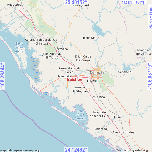
Batallón GPS coordinates[2]
24° 45' 52.956" North, 107° 35' 25.116" West
| Map corner | latitude | longitude |
|---|---|---|
| Upper-left | 25.40152°, | -108.29344° |
| Center: | 24.76471°, | -107.59031° |
| Lower-right: | 24.12462°, | -106.88719° |
| Map W x H: | 142×142 km | = 88.2×88.2mi |
| max Lat: | 32.7° ⇑8.6% North |
| Batallón: | 24.76471° |
| min Lat: | ⇓91.4% South 14.53588° |
| min Long | Batallón | max Long |
| -117.105° | -107.59031° | -86.73105° |
| W 4.9%⇐ | ⇒95.1% E |
Elevation
Elevation of Batallón is 22 m = 72 ft, and this is 1231.7 m = 4041 ft below average elevation for this country.
| Max E: |
3497 m = 11473 ft | 90.8% |
| Avg. | 1253.7 m = 4113 ft | |
| Batallón | 22 m = 72 ft | |
Min E: |
-1 m = -3 ft | 9.2% |
See also: Mexico elevation on elevation.city.
Geographical zone
Batallón is located in North temperate zone (between Tropic of Cancer and the Arctic Circle). Distance of this Northern Tropic circle is 147.7 km =91.8 mi to South.| Distance of | km | miles | from Batallón |
|---|---|---|---|
| North Pole | 7253.5 | 4507.1 | to North |
| Arctic Circle | 4647.6 | 2887.9 | to North |
| Tropic Cancer | 147.7 | 91.8 | to South |
| Equator | 2753.6 | 1711 | to South |


Nearby cities:
15 places around Batallón: (largest is in red/bold)
• Bariometo
7.3 km =4.5 mi,  271°
271°
• Campo Balbuena
4.6 km =2.9 mi,  115°
115°
• Campo Lo de Beltrán
6.1 km =3.8 mi,  337°
337°
• Cofradía de Navolato (Cofradía de los Rocha)
5.8 km =3.6 mi, 273°
• Cofradía de San Pedro
3.9 km =2.4 mi, 341°
• Colonia Michoacana
6.1 km =3.8 mi,  223°
223°
• Culiacancito
8.8 km =5.5 mi,  39°
39°
• Ejido Convención de Aguascalientes
4.3 km =2.7 mi,  260°
260°
• Estación Rosales
8.1 km =5 mi,  7°
7°
• General Ángel Flores (La Palma)
9 km =5.6 mi,  312°
312°
• La Bebelama de San Pedro
3.6 km =2.2 mi,  28°
28°
• La Curva (La Curva de San Pedro)
4.3 km =2.7 mi,  187°
187°
• La Sinaloa
3.4 km =2.1 mi, 273°
• Lo de Sauceda
4.7 km =2.9 mi,  324°
324°
• Los Arredondo (Los Arredondo de San Pedro)
2.1 km =1.3 mi,  359°
359°
Sources, notices
• [Note1] Compared only with cities in Mexico existing in our database
• [Src1] Map data: © OpenStreetMap contributors (CC-BY-SA)
• [Src2] Other city data from geonames.org with taken over terms of usage.
• [Src3] Geographical zone / Annual Mean Temperature by Robert A. Rohde @ Wikipedia
