General Ángel Flores (La Palma) geodata
General Ángel Flores (La Palma) (Sinaloa) is a populated place; located in Mexico in America/Mazatlan (GMT-7) time zone. With population of 9,812 people, there are 976 cities with bigger population in this country. Compared to other cities in Mexico, 91.5% of cities are located further ↓South; 95.2% of cities are located further →East and 93% of cities have higher elevation than General Ángel Flores (La Palma). Note1
Current local time in General Ángel Flores (La Palma):
08:12 AM, MondayDifference from your time zone: hours


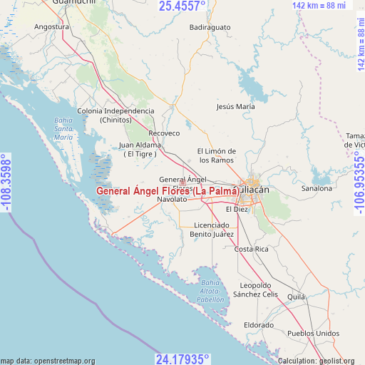
General Ángel Flores (La Palma) GPS coordinates[2]
24° 49' 9.012" North, 107° 39' 24.012" West
| Map corner | latitude | longitude |
|---|---|---|
| Upper-left | 25.4557°, | -108.3598° |
| Center: | 24.81917°, | -107.65667° |
| Lower-right: | 24.17935°, | -106.95355° |
| Map W x H: | 141.9×141.9 km | = 88.2×88.2mi |
| max Lat: | 32.7° ⇑8.5% North |
| General Ángel Flores (La Palma): | 24.81917° |
| min Lat: | ⇓91.5% South 14.53588° |
| min Long | General Ángel | max Long |
| -117.105° | -107.65667° | -86.73105° |
| W 4.8%⇐ | ⇒95.2% E |
Elevation
Elevation of General Ángel Flores (La Palma) is 17 m = 56 ft, and this is 1236.7 m = 4057 ft below average elevation for this country.
| Max E: |
3497 m = 11473 ft | 93% |
| Avg. | 1253.7 m = 4113 ft | |
| General Ángel Flores (La Palma) | 17 m = 56 ft | |
Min E: |
-1 m = -3 ft | 7% |
See also: Mexico elevation on elevation.city.
Geographical zone
General Ángel Flores (La Palma) is located in North temperate zone (between Tropic of Cancer and the Arctic Circle). Distance of this Northern Tropic circle is 153.7 km =95.5 mi to South.| Distance of | km | miles | from General Ángel Flores (La Palma) |
|---|---|---|---|
| North Pole | 7247.4 | 4503.3 | to North |
| Arctic Circle | 4641.5 | 2884.1 | to North |
| Tropic Cancer | 153.7 | 95.5 | to South |
| Equator | 2759.6 | 1714.7 | to South |


Nearby cities:
15 places around General Ángel Flores (La Palma): (largest is in red/bold)
• Adolfo López Mateos (El Tamarindo)
8.9 km =5.5 mi,  15°
15°
• Bariometo
5.8 km =3.6 mi,  185°
185°
• Batallón
9 km =5.6 mi,  132°
132°
• Campo Lo de Beltrán
4.4 km =2.7 mi,  95°
95°
• Cofradía de Navolato (Cofradía de los Rocha)
5.7 km =3.5 mi,  171°
171°
• Cofradía de San Pedro
6 km =3.7 mi,  113°
113°
• Ejido Convención de Aguascalientes
7.2 km =4.5 mi,  160°
160°
• Ejido la Paloma
2.4 km =1.5 mi,  4°
4°
• Estación Rosales
8 km =5 mi,  75°
75°
• La Bebelama de San Pedro
8.9 km =5.5 mi, 109°
• La Sinaloa
6.7 km =4.2 mi,  150°
150°
• Lo de Sauceda
4.6 km =2.9 mi,  118°
118°
• Los Arredondo (Los Arredondo de San Pedro)
7.7 km =4.8 mi, 120°
• Navolato
7.5 km =4.7 mi,  217°
217°
• Tabolato
10.2 km =6.3 mi, 222°
Sources, notices
• [Note1] Compared only with cities in Mexico existing in our database
• [Src1] Map data: © OpenStreetMap contributors (CC-BY-SA)
• [Src2] Other city data from geonames.org with taken over terms of usage.
• [Src3] Geographical zone / Annual Mean Temperature by Robert A. Rohde @ Wikipedia
