Arteaga geodata
Arteaga (Michoacán) is a seat of a second-order administrative division; located in Mexico in America/Mexico_City (GMT-6) time zone. With population of 10,537 people, there are 901 cities with bigger population in this country. Compared to other cities in Mexico, 74.2% of cities are located further ↑North; 82.8% of cities are located further →East and 62.9% of cities have higher elevation than Arteaga. Note1


Arteaga GPS coordinates[2]
18° 21' 28.044" North, 102° 17' 28.392" West
| Map corner | latitude | longitude |
|---|---|---|
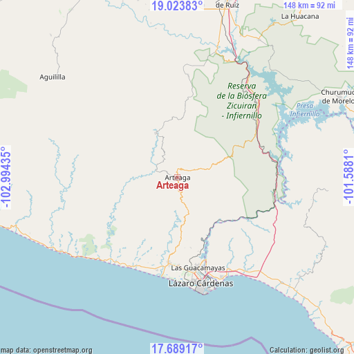
| Upper-left | 19.02383°, | -102.99435° |
| Center: | 18.35779°, | -102.29122° |
| Lower-right: | 17.68917°, | -101.5881° |
| Map W x H: | 148.4×148.4 km | = 92.2×92.2mi |
| max Lat: | 32.7° ⇑74.2% North |
| Arteaga: | 18.35779° |
| min Lat: | ⇓25.8% South 14.53588° |
| min Long | Arteaga | max Long |
| -117.105° | -102.29122° | -86.73105° |
| W 17.2%⇐ | ⇒82.8% E |
Elevation
Elevation of Arteaga is 829 m = 2720 ft, and this is 424.7 m = 1393 ft below average elevation for this country.
| Max E: |
3497 m = 11473 ft | 62.9% |
| Avg. | 1253.7 m = 4113 ft | |
| Arteaga | 829 m = 2720 ft | |
Min E: |
-1 m = -3 ft | 37.1% |
See also: Mexico elevation on elevation.city.
Geographical zone
Arteaga is located in North Torrid zone (between Equator and Tropic of Cancer). Distance of this Northern Tropic circle is 564.7 km =350.9 mi to North.| Distance of | km | miles | from Arteaga |
|---|---|---|---|
| North Pole | 7965.9 | 4949.8 | to North |
| Arctic Circle | 5360 | 3330.5 | to North |
| Tropic Cancer | 564.7 | 350.9 | to North |
| Equator | 2041.2 | 1268.3 | to South |


Nearby cities:
15 places around Arteaga: (largest is in red/bold)
• Acalpican de Morelos
38.1 km =23.7 mi,  187°
187°
• Buenos Aires
37.1 km =23.1 mi,  179°
179°
• Chucutitán
41.5 km =25.8 mi,  206°
206°
• El Bordonal
39.2 km =24.4 mi, 183°
• El Habillal
39.9 km =24.8 mi, 192°
• Guacamayas
38.5 km =23.9 mi,  167°
167°
• La Mira
36.2 km =22.5 mi, 185°
• La Mira Tumbiscatio
36.2 km =22.5 mi,  1°
1°
• La Orilla
40.8 km =25.4 mi, 170°
• Las Cañas
40.5 km =25.2 mi,  55°
55°
• Los Coyotes
26.8 km =16.7 mi, 177°
• Puente de la Vía
39.2 km =24.4 mi, 173°
• Tamacuas (El Ranchito)
38.1 km =23.7 mi,  161°
161°
• Tumbiscatío de Ruiz
20.9 km =13 mi,  333°
333°
• Zacatula
40.5 km =25.2 mi, 163°
Sources, notices
• [Note1] Compared only with cities in Mexico existing in our database
• [Src1] Map data: © OpenStreetMap contributors (CC-BY-SA)
• [Src2] Other city data from geonames.org with taken over terms of usage.
• [Src3] Geographical zone / Annual Mean Temperature by Robert A. Rohde @ Wikipedia
