Noria del Borrego (Norias) geodata
Noria del Borrego (Norias) (Aguascalientes) is a populated place; located in Mexico in America/Mexico_City (GMT-6) time zone. With population of 1,186 people, there are 7322 cities with bigger population in this country. Compared to other cities in Mexico, 85.7% of cities are located further ↓South; 81.2% of cities are located further →East and 75.1% of cities have lower elevation than Noria del Borrego (Norias). Note1
Current local time in Noria del Borrego (Norias):
09:49 PM, TuesdayDifference from your time zone: hours


Noria del Borrego (Norias) GPS coordinates[2]
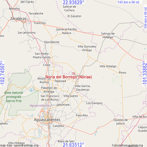
22° 17' 13.992" North, 102° 2' 30.984" West
| Map corner | latitude | longitude |
|---|---|---|
| Upper-left | 22.93629°, | -102.74507° |
| Center: | 22.28722°, | -102.04194° |
| Lower-right: | 21.63512°, | -101.33882° |
| Map W x H: | 144.7×144.7 km | = 89.9×89.9mi |
| max Lat: | 32.7° ⇑14.3% North |
| Noria del Borrego (Norias): | 22.28722° |
| min Lat: | ⇓85.7% South 14.53588° |
| min Long | Noria del Borre | max Long |
| -117.105° | -102.04194° | -86.73105° |
| W 18.8%⇐ | ⇒81.2% E |
Elevation
Elevation of Noria del Borrego (Norias) is 2032 m = 6667 ft, and this is 778.3 m = 2553 ft above average elevation for this country.
| Max E: |
3497 m = 11473 ft | 24.9% |
| Noria del Borrego (Norias) | 2032 m 6667 ft | |
| Avg. | 1253.7 m = 4113 ft | |
Min E: |
-1 m = -3 ft | 75.1% |
See also: Mexico elevation on elevation.city.
Geographical zone
Noria del Borrego (Norias) is located in North Torrid zone (between Equator and Tropic of Cancer). Distance of this Northern Tropic circle is 127.8 km =79.4 mi to North.| Distance of | km | miles | from Noria del Borrego (Norias) |
|---|---|---|---|
| North Pole | 7529 | 4678.3 | to North |
| Arctic Circle | 4923.1 | 3059.1 | to North |
| Tropic Cancer | 127.8 | 79.4 | to North |
| Equator | 2478.1 | 1539.8 | to South |


Nearby cities:
15 places around Noria del Borrego (Norias): (largest is in red/bold)
• Asientos
7.3 km =4.5 mi,  221°
221°
• Bimbaletes
5.9 km =3.7 mi,  137°
137°
• Bimbaletes Aguascalientes (El Álamo)
6.3 km =3.9 mi,  158°
158°
• Bimbaletes Atlas
4.7 km =2.9 mi,  171°
171°
• Colonia Hidalgo (El Tecolote)
4.8 km =3 mi,  7°
7°
• Crisóstomos
8 km =5 mi, 143°
• Ejido Hidalgo
1.6 km =1 mi, 12°
• El Prieto
2.2 km =1.4 mi,  56°
56°
• Felipe Carrillo Puerto
6.6 km =4.1 mi,  285°
285°
• Guadalupe de Atlas
2.6 km =1.6 mi,  154°
154°
• Jarillas
2.4 km =1.5 mi, 294°
• La Loma (El Bajío)
7 km =4.3 mi,  124°
124°
• Loreto
5.7 km =3.5 mi,  106°
106°
• Norias de Guadalupe
3.7 km =2.3 mi, 121°
• Tierra Blanca
7.2 km =4.5 mi,  340°
340°
Sources, notices
• [Note1] Compared only with cities in Mexico existing in our database
• [Src1] Map data: © OpenStreetMap contributors (CC-BY-SA)
• [Src2] Other city data from geonames.org with taken over terms of usage.
• [Src3] Geographical zone / Annual Mean Temperature by Robert A. Rohde @ Wikipedia
