Chirimoya (Estación Chirimoya) geodata
Chirimoya (Estación Chirimoya) (Guanajuato) is a populated place; located in Mexico in America/Mexico_City (GMT-6) time zone. With population of 1,014 people, there are 8595 cities with bigger population in this country. Compared to other cities in Mexico, 81.9% of cities are located further ↓South; 74.2% of cities are located further →East and 67.4% of cities have lower elevation than Chirimoya (Estación Chirimoya). Note1
Current local time in Chirimoya (Estación Chirimoya):
10:03 AM, MondayDifference from your time zone: hours


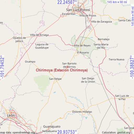
Chirimoya (Estación Chirimoya) GPS coordinates[2]
21° 35' 34.008" North, 101° 5' 29.004" West
| Map corner | latitude | longitude |
|---|---|---|
| Upper-left | 22.24507°, | -101.79452° |
| Center: | 21.59278°, | -101.09139° |
| Lower-right: | 20.93753°, | -100.38827° |
| Map W x H: | 145.4×145.4 km | = 90.3×90.3mi |
| max Lat: | 32.7° ⇑18.1% North |
| Chirimoya (Estación Chirimoya): | 21.59278° |
| min Lat: | ⇓81.9% South 14.53588° |
| min Long | Chirimoya (Esta | max Long |
| -117.105° | -101.09139° | -86.73105° |
| W 25.8%⇐ | ⇒74.2% E |
Elevation
Elevation of Chirimoya (Estación Chirimoya) is 1877 m = 6158 ft, and this is 623.3 m = 2045 ft above average elevation for this country.
| Max E: |
3497 m = 11473 ft | 32.6% |
| Chirimoya (Estación Chirimoya) | 1877 m 6158 ft | |
| Avg. | 1253.7 m = 4113 ft | |
Min E: |
-1 m = -3 ft | 67.4% |
See also: Mexico elevation on elevation.city.
Geographical zone
Chirimoya (Estación Chirimoya) is located in North Torrid zone (between Equator and Tropic of Cancer). Distance of this Northern Tropic circle is 205 km =127.4 mi to North.| Distance of | km | miles | from Chirimoya (Estación Chirimoya) |
|---|---|---|---|
| North Pole | 7606.2 | 4726.3 | to North |
| Arctic Circle | 5000.3 | 3107 | to North |
| Tropic Cancer | 205 | 127.4 | to North |
| Equator | 2400.9 | 1491.8 | to South |


Nearby cities:
15 places around Chirimoya (Estación Chirimoya): (largest is in red/bold)
• Chirimoya Vieja
4.1 km =2.5 mi,  188°
188°
• Ejido Hernández Álvarez
16.5 km =10.3 mi,  232°
232°
• El Carretón
12.2 km =7.6 mi,  69°
69°
• El Huizache
6.5 km =4 mi,  263°
263°
• El Zapote
16.5 km =10.3 mi,  15°
15°
• Emiliano Zapata
14.2 km =8.8 mi, 72°
• Estancia de San Francisco
8.6 km =5.3 mi, 18°
• La Sauceda de la Luz
10.5 km =6.5 mi,  282°
282°
• Los Díaz
16 km =9.9 mi,  216°
216°
• Puerto de Sandoval
8.3 km =5.2 mi, 194°
• San Bartolo de Berrios
3.2 km =2 mi,  47°
47°
• San Francisco
5.7 km =3.5 mi,  36°
36°
• San José de Rancho Nuevo (Los Arrieros)
9.1 km =5.7 mi,  87°
87°
• Santa Catarina
6.2 km =3.9 mi,  157°
157°
• Santa Rosa
4.6 km =2.9 mi,  180°
180°
Sources, notices
• [Note1] Compared only with cities in Mexico existing in our database
• [Src1] Map data: © OpenStreetMap contributors (CC-BY-SA)
• [Src2] Other city data from geonames.org with taken over terms of usage.
• [Src3] Geographical zone / Annual Mean Temperature by Robert A. Rohde @ Wikipedia
