El Huizache geodata
El Huizache (Guanajuato) is a populated place; located in Mexico in America/Mexico_City (GMT-6) time zone. With population of 571 people, there are 14980 cities with bigger population in this country. Compared to other cities in Mexico, 81.9% of cities are located further ↓South; 74.6% of cities are located further →East and 74.3% of cities have lower elevation than El Huizache. Note1


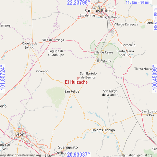
El Huizache GPS coordinates[2]
21° 35' 8.34" North, 101° 9' 14.796" West
| Map corner | latitude | longitude |
|---|---|---|
| Upper-left | 22.23798°, | -101.85724° |
| Center: | 21.58565°, | -101.15411° |
| Lower-right: | 20.93037°, | -100.45099° |
| Map W x H: | 145.4×145.4 km | = 90.3×90.3mi |
| max Lat: | 32.7° ⇑18.1% North |
| El Huizache: | 21.58565° |
| min Lat: | ⇓81.9% South 14.53588° |
| min Long | El Huizache | max Long |
| -117.105° | -101.15411° | -86.73105° |
| W 25.4%⇐ | ⇒74.6% E |
Elevation
Elevation of El Huizache is 2018 m = 6621 ft, and this is 764.3 m = 2508 ft above average elevation for this country.
| Max E: |
3497 m = 11473 ft | 25.7% |
| El Huizache | 2018 m 6621 ft | |
| Avg. | 1253.7 m = 4113 ft | |
Min E: |
-1 m = -3 ft | 74.3% |
See also: Mexico elevation on elevation.city.
Geographical zone
El Huizache is located in North Torrid zone (between Equator and Tropic of Cancer). Distance of this Northern Tropic circle is 205.8 km =127.9 mi to North.| Distance of | km | miles | from El Huizache |
|---|---|---|---|
| North Pole | 7607 | 4726.8 | to North |
| Arctic Circle | 5001.1 | 3107.5 | to North |
| Tropic Cancer | 205.8 | 127.9 | to North |
| Equator | 2400.1 | 1491.4 | to South |


Nearby cities:
15 places around El Huizache: (largest is in red/bold)
• Chirimoya (Estación Chirimoya)
6.5 km =4 mi,  83°
83°
• Chirimoya Vieja
6.7 km =4.2 mi,  119°
119°
• Ejido Hernández Álvarez
11.4 km =7.1 mi,  215°
215°
• Estancia de San Francisco
12.9 km =8 mi,  45°
45°
• La Sauceda de la Luz
4.8 km =3 mi,  309°
309°
• Los Díaz
12.4 km =7.7 mi,  194°
194°
• Molino de San José
11.5 km =7.1 mi,  261°
261°
• Puerto de Sandoval
8.5 km =5.3 mi,  148°
148°
• San Andrés del Cubo
15.7 km =9.8 mi,  169°
169°
• San Bartolo de Berrios
9.3 km =5.8 mi,  71°
71°
• San Felipe
13.5 km =8.4 mi,  208°
208°
• San Francisco
11.2 km =7 mi,  61°
61°
• San José de Rancho Nuevo (Los Arrieros)
15.6 km =9.7 mi,  85°
85°
• Santa Catarina
10.1 km =6.3 mi, 119°
• Santa Rosa
7.4 km =4.6 mi, 120°
Sources, notices
• [Note1] Compared only with cities in Mexico existing in our database
• [Src1] Map data: © OpenStreetMap contributors (CC-BY-SA)
• [Src2] Other city data from geonames.org with taken over terms of usage.
• [Src3] Geographical zone / Annual Mean Temperature by Robert A. Rohde @ Wikipedia
