La Escondida geodata
La Escondida (Guanajuato) is a populated place; located in Mexico in America/Mexico_City (GMT-6) time zone. With population of 2,040 people, there are 4272 cities with bigger population in this country. Compared to other cities in Mexico, 82.4% of cities are located further ↓South; 77.7% of cities are located further →East and 82% of cities have lower elevation than La Escondida. Note1


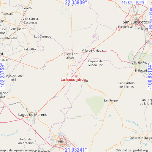
La Escondida GPS coordinates[2]
21° 41' 14.028" North, 101° 32' 4.056" West
| Map corner | latitude | longitude |
|---|---|---|
| Upper-left | 22.33909°, | -102.23759° |
| Center: | 21.68723°, | -101.53446° |
| Lower-right: | 21.03241°, | -100.83134° |
| Map W x H: | 145.3×145.3 km | = 90.3×90.3mi |
| max Lat: | 32.7° ⇑17.6% North |
| La Escondida: | 21.68723° |
| min Lat: | ⇓82.4% South 14.53588° |
| min Long | La Escondida | max Long |
| -117.105° | -101.53446° | -86.73105° |
| W 22.3%⇐ | ⇒77.7% E |
Elevation
Elevation of La Escondida is 2190 m = 7185 ft, and this is 936.3 m = 3072 ft above average elevation for this country.
| Max E: |
3497 m = 11473 ft | 18% |
| La Escondida | 2190 m 7185 ft | |
| Avg. | 1253.7 m = 4113 ft | |
Min E: |
-1 m = -3 ft | 82% |
See also: Mexico elevation on elevation.city.
Geographical zone
La Escondida is located in North Torrid zone (between Equator and Tropic of Cancer). Distance of this Northern Tropic circle is 194.5 km =120.9 mi to North.| Distance of | km | miles | from La Escondida |
|---|---|---|---|
| North Pole | 7595.7 | 4719.7 | to North |
| Arctic Circle | 4989.8 | 3100.5 | to North |
| Tropic Cancer | 194.5 | 120.9 | to North |
| Equator | 2411.4 | 1498.4 | to South |


Nearby cities:
15 places around La Escondida: (largest is in red/bold)
• Agua Gorda de los Patos
22.5 km =14 mi,  17°
17°
• El Potrero
14.7 km =9.1 mi,  116°
116°
• Fraccionamiento San Antonio
7.8 km =4.8 mi, 115°
• Gachupines
8.9 km =5.5 mi,  340°
340°
• Guadalupe Victoria
8.7 km =5.4 mi,  280°
280°
• La Haciendita
13.2 km =8.2 mi, 124°
• La Tinaja
11.2 km =7 mi,  142°
142°
• Laguna de Guadalupe
22.2 km =13.8 mi,  55°
55°
• Las Trojes
19.7 km =12.2 mi, 138°
• Matanzas
13.8 km =8.6 mi,  244°
244°
• Ocampo
7.2 km =4.5 mi,  128°
128°
• Ojuelos de Jalisco
20.8 km =12.9 mi, 343°
• Providencia de Guadalupe (Estancia)
19.1 km =11.9 mi,  42°
42°
• San Pedro de Ibarra
22.7 km =14.1 mi,  181°
181°
• Vaquerías
15.3 km =9.5 mi,  306°
306°
Sources, notices
• [Note1] Compared only with cities in Mexico existing in our database
• [Src1] Map data: © OpenStreetMap contributors (CC-BY-SA)
• [Src2] Other city data from geonames.org with taken over terms of usage.
• [Src3] Geographical zone / Annual Mean Temperature by Robert A. Rohde @ Wikipedia
