San Pedro de Ibarra geodata
San Pedro de Ibarra (Guanajuato) is a populated place; located in Mexico in America/Mexico_City (GMT-6) time zone. With population of 1,164 people, there are 7452 cities with bigger population in this country. Compared to other cities in Mexico, 81.3% of cities are located further ↓South; 77.7% of cities are located further →East and 80.2% of cities have lower elevation than San Pedro de Ibarra. Note1


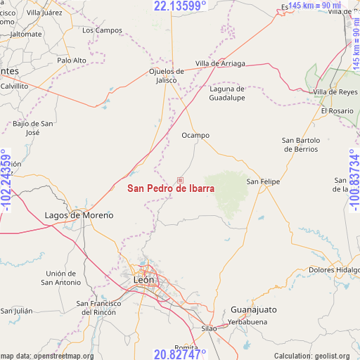
San Pedro de Ibarra GPS coordinates[2]
21° 28' 59.52" North, 101° 32' 25.656" West
| Map corner | latitude | longitude |
|---|---|---|
| Upper-left | 22.13599°, | -102.24359° |
| Center: | 21.4832°, | -101.54046° |
| Lower-right: | 20.82747°, | -100.83734° |
| Map W x H: | 145.5×145.5 km | = 90.4×90.4mi |
| max Lat: | 32.7° ⇑18.7% North |
| San Pedro de Ibarra: | 21.4832° |
| min Lat: | ⇓81.3% South 14.53588° |
| min Long | San Pedro de Ib | max Long |
| -117.105° | -101.54046° | -86.73105° |
| W 22.3%⇐ | ⇒77.7% E |
Elevation
Elevation of San Pedro de Ibarra is 2145 m = 7037 ft, and this is 891.3 m = 2924 ft above average elevation for this country.
| Max E: |
3497 m = 11473 ft | 19.8% |
| San Pedro de Ibarra | 2145 m 7037 ft | |
| Avg. | 1253.7 m = 4113 ft | |
Min E: |
-1 m = -3 ft | 80.2% |
See also: Mexico elevation on elevation.city.
Geographical zone
San Pedro de Ibarra is located in North Torrid zone (between Equator and Tropic of Cancer). Distance of this Northern Tropic circle is 217.2 km =135 mi to North.| Distance of | km | miles | from San Pedro de Ibarra |
|---|---|---|---|
| North Pole | 7618.4 | 4733.9 | to North |
| Arctic Circle | 5012.5 | 3114.6 | to North |
| Tropic Cancer | 217.2 | 135 | to North |
| Equator | 2388.7 | 1484.3 | to South |


Nearby cities:
15 places around San Pedro de Ibarra: (largest is in red/bold)
• Comanja de Corona
25.1 km =15.6 mi,  225°
225°
• Dieciocho de Marzo
26.7 km =16.6 mi,  269°
269°
• El Potrero
21.3 km =13.2 mi,  40°
40°
• Fraccionamiento San Antonio
20.7 km =12.9 mi,  21°
21°
• Fuerte Viejo
22.9 km =14.2 mi,  64°
64°
• Guadalupe Victoria
25.5 km =15.8 mi,  341°
341°
• La Escondida
22.7 km =14.1 mi,  1°
1°
• La Haciendita
19 km =11.8 mi, 37°
• La Tinaja
15.7 km =9.8 mi,  28°
28°
• Las Trojes
15.9 km =9.9 mi, 59°
• Matanzas
20.5 km =12.7 mi,  324°
324°
• Ocampo
19.2 km =11.9 mi, 18°
• Paso de Cuarenta
22 km =13.7 mi,  275°
275°
• San José del Torreón
7.3 km =4.5 mi,  97°
97°
• Santa Bárbara
17.9 km =11.1 mi,  70°
70°
Sources, notices
• [Note1] Compared only with cities in Mexico existing in our database
• [Src1] Map data: © OpenStreetMap contributors (CC-BY-SA)
• [Src2] Other city data from geonames.org with taken over terms of usage.
• [Src3] Geographical zone / Annual Mean Temperature by Robert A. Rohde @ Wikipedia
