Caleras de Ameche geodata
Caleras de Ameche (Guanajuato) is a populated place; located in Mexico in America/Mexico_City (GMT-6) time zone. With population of 1,967 people, there are 4433 cities with bigger population in this country. Compared to other cities in Mexico, 69.1% of cities are located further ↓South; 70% of cities are located further →East and 64.1% of cities have lower elevation than Caleras de Ameche. Note1


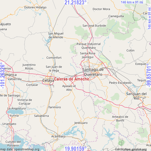
Caleras de Ameche GPS coordinates[2]
20° 33' 40.788" North, 100° 33' 36.468" West
| Map corner | latitude | longitude |
|---|---|---|
| Upper-left | 21.21823°, | -101.26326° |
| Center: | 20.56133°, | -100.56013° |
| Lower-right: | 19.90159°, | -99.85701° |
| Map W x H: | 146.4×146.4 km | = 91×91mi |
| max Lat: | 32.7° ⇑30.9% North |
| Caleras de Ameche: | 20.56133° |
| min Lat: | ⇓69.1% South 14.53588° |
| min Long | Caleras de Amec | max Long |
| -117.105° | -100.56013° | -86.73105° |
| W 30%⇐ | ⇒70% E |
Elevation
Elevation of Caleras de Ameche is 1802 m = 5912 ft, and this is 548.3 m = 1799 ft above average elevation for this country.
| Max E: |
3497 m = 11473 ft | 35.9% |
| Caleras de Ameche | 1802 m 5912 ft | |
| Avg. | 1253.7 m = 4113 ft | |
Min E: |
-1 m = -3 ft | 64.1% |
See also: Mexico elevation on elevation.city.
Geographical zone
Caleras de Ameche is located in North Torrid zone (between Equator and Tropic of Cancer). Distance of this Northern Tropic circle is 319.7 km =198.7 mi to North.| Distance of | km | miles | from Caleras de Ameche |
|---|---|---|---|
| North Pole | 7720.9 | 4797.5 | to North |
| Arctic Circle | 5115 | 3178.3 | to North |
| Tropic Cancer | 319.7 | 198.7 | to North |
| Equator | 2286.2 | 1420.6 | to South |


Nearby cities:
15 places around Caleras de Ameche: (largest is in red/bold)
• Ameche
2.6 km =1.6 mi,  248°
248°
• Caleras de Obrajuelo
0.9 km =0.6 mi,  24°
24°
• Coachiti
3.1 km =1.9 mi,  266°
266°
• Colonia los Ángeles
8 km =5 mi,  111°
111°
• El Castillo
7.3 km =4.5 mi,  72°
72°
• El Nacimiento
5.9 km =3.7 mi,  241°
241°
• El Romeral
7.3 km =4.5 mi, 111°
• El Tunal
6.3 km =3.9 mi,  278°
278°
• La Norita
4.6 km =2.9 mi,  100°
100°
• Marroquín
5.6 km =3.5 mi,  179°
179°
• Obrajuelo
3.6 km =2.2 mi,  1°
1°
• San Antonio Calichar
8.4 km =5.2 mi,  148°
148°
• San Bartolomé Aguas Calientes
7.4 km =4.6 mi,  170°
170°
• San José Viborillas
7.7 km =4.8 mi, 275°
• San Juan del Llanito
5.7 km =3.5 mi,  158°
158°
Sources, notices
• [Note1] Compared only with cities in Mexico existing in our database
• [Src1] Map data: © OpenStreetMap contributors (CC-BY-SA)
• [Src2] Other city data from geonames.org with taken over terms of usage.
• [Src3] Geographical zone / Annual Mean Temperature by Robert A. Rohde @ Wikipedia
