Coachiti geodata
Coachiti (Guanajuato) is a populated place; located in Mexico in America/Mexico_City (GMT-6) time zone. With population of 1,775 people, there are 4892 cities with bigger population in this country. Compared to other cities in Mexico, 69.1% of cities are located further ↓South; 70.2% of cities are located further →East and 63.6% of cities have lower elevation than Coachiti. Note1


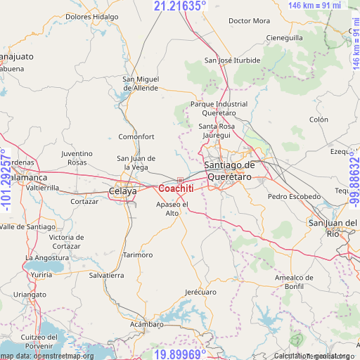
Coachiti GPS coordinates[2]
20° 33' 33.984" North, 100° 35' 21.984" West
| Map corner | latitude | longitude |
|---|---|---|
| Upper-left | 21.21635°, | -101.29257° |
| Center: | 20.55944°, | -100.58944° |
| Lower-right: | 19.89969°, | -99.88632° |
| Map W x H: | 146.4×146.4 km | = 91×91mi |
| max Lat: | 32.7° ⇑30.9% North |
| Coachiti: | 20.55944° |
| min Lat: | ⇓69.1% South 14.53588° |
| min Long | Coachiti | max Long |
| -117.105° | -100.58944° | -86.73105° |
| W 29.8%⇐ | ⇒70.2% E |
Elevation
Elevation of Coachiti is 1791 m = 5876 ft, and this is 537.3 m = 1763 ft above average elevation for this country.
| Max E: |
3497 m = 11473 ft | 36.4% |
| Coachiti | 1791 m 5876 ft | |
| Avg. | 1253.7 m = 4113 ft | |
Min E: |
-1 m = -3 ft | 63.6% |
See also: Mexico elevation on elevation.city.
Geographical zone
Coachiti is located in North Torrid zone (between Equator and Tropic of Cancer). Distance of this Northern Tropic circle is 319.9 km =198.8 mi to North.| Distance of | km | miles | from Coachiti |
|---|---|---|---|
| North Pole | 7721.1 | 4797.7 | to North |
| Arctic Circle | 5115.2 | 3178.4 | to North |
| Tropic Cancer | 319.9 | 198.8 | to North |
| Equator | 2286 | 1420.5 | to South |


Nearby cities:
15 places around Coachiti: (largest is in red/bold)
• Ameche
1 km =0.6 mi,  141°
141°
• Caleras de Ameche
3.1 km =1.9 mi,  86°
86°
• Caleras de Obrajuelo
3.6 km =2.2 mi,  73°
73°
• El Nacimiento
3.4 km =2.1 mi,  219°
219°
• El Sabino
8.1 km =5 mi,  180°
180°
• El Tunal
3.4 km =2.1 mi,  289°
289°
• Guadalupe del Monte
5.3 km =3.3 mi,  266°
266°
• La Norita
7.6 km =4.7 mi, 94°
• Marroquín
6.2 km =3.9 mi,  149°
149°
• Obrajuelo
4.9 km =3 mi,  39°
39°
• San Bartolomé Aguas Calientes
8.3 km =5.2 mi, 148°
• San Cristóbal
6.7 km =4.2 mi,  203°
203°
• San José Viborillas
4.7 km =2.9 mi,  281°
281°
• San Juan del Llanito
7.3 km =4.5 mi,  134°
134°
• San Pedro Tenango
7.3 km =4.5 mi, 217°
Sources, notices
• [Note1] Compared only with cities in Mexico existing in our database
• [Src1] Map data: © OpenStreetMap contributors (CC-BY-SA)
• [Src2] Other city data from geonames.org with taken over terms of usage.
• [Src3] Geographical zone / Annual Mean Temperature by Robert A. Rohde @ Wikipedia
