Chamacua geodata
Chamacua (Guanajuato) is a populated place; located in Mexico in America/Mexico_City (GMT-6) time zone. With population of 726 people, there are 12023 cities with bigger population in this country. Compared to other cities in Mexico, 71.3% of cities are located further ↓South; 77.9% of cities are located further →East and 58.8% of cities have lower elevation than Chamacua. Note1


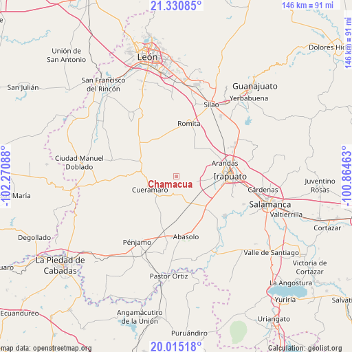
Chamacua GPS coordinates[2]
20° 40' 27.984" North, 101° 34' 3.9" West
| Map corner | latitude | longitude |
|---|---|---|
| Upper-left | 21.33085°, | -102.27088° |
| Center: | 20.67444°, | -101.56775° |
| Lower-right: | 20.01518°, | -100.86463° |
| Map W x H: | 146.3×146.3 km | = 90.9×90.9mi |
| max Lat: | 32.7° ⇑28.7% North |
| Chamacua: | 20.67444° |
| min Lat: | ⇓71.3% South 14.53588° |
| min Long | Chamacua | max Long |
| -117.105° | -101.56775° | -86.73105° |
| W 22.1%⇐ | ⇒77.9% E |
Elevation
Elevation of Chamacua is 1704 m = 5591 ft, and this is 450.3 m = 1477 ft above average elevation for this country.
| Max E: |
3497 m = 11473 ft | 41.2% |
| Chamacua | 1704 m 5591 ft | |
| Avg. | 1253.7 m = 4113 ft | |
Min E: |
-1 m = -3 ft | 58.8% |
See also: Mexico elevation on elevation.city.
Geographical zone
Chamacua is located in North Torrid zone (between Equator and Tropic of Cancer). Distance of this Northern Tropic circle is 307.1 km =190.8 mi to North.| Distance of | km | miles | from Chamacua |
|---|---|---|---|
| North Pole | 7708.3 | 4789.7 | to North |
| Arctic Circle | 5102.4 | 3170.5 | to North |
| Tropic Cancer | 307.1 | 190.8 | to North |
| Equator | 2298.8 | 1428.4 | to South |


Nearby cities:
15 places around Chamacua: (largest is in red/bold)
• Cerrito de Agua Caliente
4.6 km =2.9 mi,  203°
203°
• Galera de la Grulla
8.1 km =5 mi,  237°
237°
• Horta (San Antonio de Horta)
8 km =5 mi,  131°
131°
• La Joya de Calvillo
9.3 km =5.8 mi,  332°
332°
• Las Masas (La Luz Masas)
8.8 km =5.5 mi,  162°
162°
• Loma de la Esperanza
2 km =1.2 mi,  145°
145°
• Puerto de la Cruz
3.5 km =2.2 mi, 327°
• Purísima de Covarrubias
10.7 km =6.6 mi,  124°
124°
• Rancho Nuevo de la Cruz
5.8 km =3.6 mi, 116°
• San Antonio Cerro Prieto
10.2 km =6.3 mi,  304°
304°
• San Cristóbal
9.6 km =6 mi,  101°
101°
• San Francisco de Horta (El Alacrán)
11 km =6.8 mi,  172°
172°
• San Francisco de Horta (El Gato)
7 km =4.3 mi, 145°
• San Rafael de Horta
6 km =3.7 mi, 153°
• Vista Hermosa
10.2 km =6.3 mi,  31°
31°
Sources, notices
• [Note1] Compared only with cities in Mexico existing in our database
• [Src1] Map data: © OpenStreetMap contributors (CC-BY-SA)
• [Src2] Other city data from geonames.org with taken over terms of usage.
• [Src3] Geographical zone / Annual Mean Temperature by Robert A. Rohde @ Wikipedia
