San Rafael de Horta geodata
San Rafael de Horta (Guanajuato) is a populated place; located in Mexico in America/Mexico_City (GMT-6) time zone. With population of 626 people, there are 13818 cities with bigger population in this country. Compared to other cities in Mexico, 70.5% of cities are located further ↓South; 77.7% of cities are located further →East and 58.5% of cities have lower elevation than San Rafael de Horta. Note1


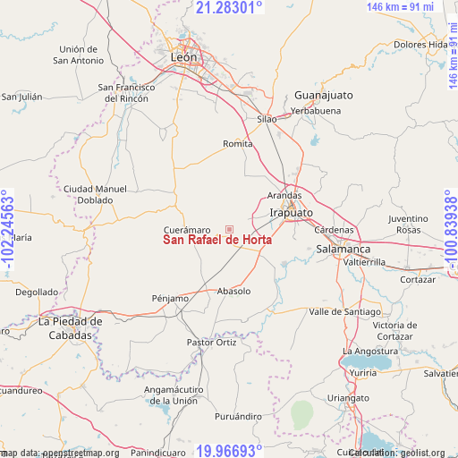
San Rafael de Horta GPS coordinates[2]
20° 37' 35.004" North, 101° 32' 33" West
| Map corner | latitude | longitude |
|---|---|---|
| Upper-left | 21.28301°, | -102.24563° |
| Center: | 20.62639°, | -101.5425° |
| Lower-right: | 19.96693°, | -100.83938° |
| Map W x H: | 146.3×146.3 km | = 90.9×90.9mi |
| max Lat: | 32.7° ⇑29.5% North |
| San Rafael de Horta: | 20.62639° |
| min Lat: | ⇓70.5% South 14.53588° |
| min Long | San Rafael de H | max Long |
| -117.105° | -101.5425° | -86.73105° |
| W 22.3%⇐ | ⇒77.7% E |
Elevation
Elevation of San Rafael de Horta is 1699 m = 5574 ft, and this is 445.3 m = 1461 ft above average elevation for this country.
| Max E: |
3497 m = 11473 ft | 41.5% |
| San Rafael de Horta | 1699 m 5574 ft | |
| Avg. | 1253.7 m = 4113 ft | |
Min E: |
-1 m = -3 ft | 58.5% |
See also: Mexico elevation on elevation.city.
Geographical zone
San Rafael de Horta is located in North Torrid zone (between Equator and Tropic of Cancer). Distance of this Northern Tropic circle is 312.5 km =194.2 mi to North.| Distance of | km | miles | from San Rafael de Horta |
|---|---|---|---|
| North Pole | 7713.6 | 4793 | to North |
| Arctic Circle | 5107.7 | 3173.8 | to North |
| Tropic Cancer | 312.5 | 194.2 | to North |
| Equator | 2293.4 | 1425.1 | to South |


Nearby cities:
15 places around San Rafael de Horta: (largest is in red/bold)
• Cerrito de Agua Caliente
4.6 km =2.9 mi,  284°
284°
• Chamacua
6 km =3.7 mi,  333°
333°
• Colonia Hermosillo
5.5 km =3.4 mi,  164°
164°
• Estación Joaquín
7.7 km =4.8 mi, 162°
• Guadalupe de Rivera
8.2 km =5.1 mi,  106°
106°
• Horta (San Antonio de Horta)
3.4 km =2.1 mi,  88°
88°
• La Carroza
8.5 km =5.3 mi,  217°
217°
• La Trinidad
7.5 km =4.7 mi,  129°
129°
• Las Masas (La Luz Masas)
3 km =1.9 mi,  180°
180°
• Loma de la Esperanza
3.9 km =2.4 mi,  337°
337°
• Purísima de Covarrubias
6.2 km =3.9 mi,  97°
97°
• Rancho Nuevo de la Cruz
3.8 km =2.4 mi,  43°
43°
• San Cristóbal
7.7 km =4.8 mi,  62°
62°
• San Francisco de Horta (El Alacrán)
5.7 km =3.5 mi,  191°
191°
• San Francisco de Horta (El Gato)
1.4 km =0.9 mi, 110°
Sources, notices
• [Note1] Compared only with cities in Mexico existing in our database
• [Src1] Map data: © OpenStreetMap contributors (CC-BY-SA)
• [Src2] Other city data from geonames.org with taken over terms of usage.
• [Src3] Geographical zone / Annual Mean Temperature by Robert A. Rohde @ Wikipedia
