Monte de Hoyos geodata
Monte de Hoyos (Guanajuato) is a populated place; located in Mexico in America/Mexico_City (GMT-6) time zone. With population of 820 people, there are 10646 cities with bigger population in this country. Compared to other cities in Mexico, 73.5% of cities are located further ↓South; 78.7% of cities are located further →East and 61.5% of cities have lower elevation than Monte de Hoyos. Note1


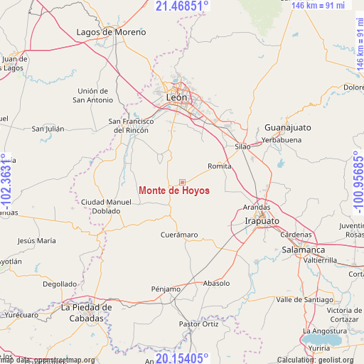
Monte de Hoyos GPS coordinates[2]
20° 48' 45.756" North, 101° 39' 35.892" West
| Map corner | latitude | longitude |
|---|---|---|
| Upper-left | 21.46851°, | -102.3631° |
| Center: | 20.81271°, | -101.65997° |
| Lower-right: | 20.15405°, | -100.95685° |
| Map W x H: | 146.2×146.2 km | = 90.8×90.8mi |
| max Lat: | 32.7° ⇑26.5% North |
| Monte de Hoyos: | 20.81271° |
| min Lat: | ⇓73.5% South 14.53588° |
| min Long | Monte de Hoyos | max Long |
| -117.105° | -101.65997° | -86.73105° |
| W 21.3%⇐ | ⇒78.7% E |
Elevation
Elevation of Monte de Hoyos is 1750 m = 5741 ft, and this is 496.3 m = 1628 ft above average elevation for this country.
| Max E: |
3497 m = 11473 ft | 38.5% |
| Monte de Hoyos | 1750 m 5741 ft | |
| Avg. | 1253.7 m = 4113 ft | |
Min E: |
-1 m = -3 ft | 61.5% |
See also: Mexico elevation on elevation.city.
Geographical zone
Monte de Hoyos is located in North Torrid zone (between Equator and Tropic of Cancer). Distance of this Northern Tropic circle is 291.8 km =181.3 mi to North.| Distance of | km | miles | from Monte de Hoyos |
|---|---|---|---|
| North Pole | 7692.9 | 4780.1 | to North |
| Arctic Circle | 5087 | 3160.9 | to North |
| Tropic Cancer | 291.8 | 181.3 | to North |
| Equator | 2314.2 | 1438 | to South |


Nearby cities:
15 places around Monte de Hoyos: (largest is in red/bold)
• Cruz de Aguilar
6.8 km =4.2 mi,  87°
87°
• El Camaleón
8.8 km =5.5 mi,  18°
18°
• El Carmen de Sánchez
10 km =6.2 mi,  104°
104°
• El Mármol
9.1 km =5.7 mi,  66°
66°
• Gavia de Rionda
5.1 km =3.2 mi,  62°
62°
• La Gloria
6.4 km =4 mi,  296°
296°
• La Joya de Calvillo
8.9 km =5.5 mi,  142°
142°
• La Sardina
7.6 km =4.7 mi,  356°
356°
• Los Amoles
3.9 km =2.4 mi,  119°
119°
• Lourdes
9.1 km =5.7 mi,  48°
48°
• San Antonio Cerro Prieto
9.7 km =6 mi,  173°
173°
• San Isidro Ojo de Agua
3.8 km =2.4 mi,  178°
178°
• San Juan de la Puerta
10.7 km =6.6 mi,  211°
211°
• Santa Efigenia
2.2 km =1.4 mi,  237°
237°
• Santa Rosalía de Gavia
2.2 km =1.4 mi,  76°
76°
Sources, notices
• [Note1] Compared only with cities in Mexico existing in our database
• [Src1] Map data: © OpenStreetMap contributors (CC-BY-SA)
• [Src2] Other city data from geonames.org with taken over terms of usage.
• [Src3] Geographical zone / Annual Mean Temperature by Robert A. Rohde @ Wikipedia
