La Cinta geodata
La Cinta (Guanajuato) is a populated place; located in Mexico in America/Mexico_City (GMT-6) time zone. With population of 910 people, there are 9586 cities with bigger population in this country. Compared to other cities in Mexico, 75.9% of cities are located further ↓South; 68.7% of cities are located further →East and 79.7% of cities have lower elevation than La Cinta. Note1


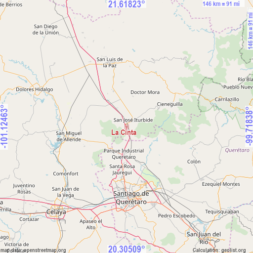
La Cinta GPS coordinates[2]
20° 57' 47.16" North, 100° 25' 17.4" West
| Map corner | latitude | longitude |
|---|---|---|
| Upper-left | 21.61823°, | -101.12463° |
| Center: | 20.9631°, | -100.4215° |
| Lower-right: | 20.30509°, | -99.71838° |
| Map W x H: | 146×146 km | = 90.7×90.7mi |
| max Lat: | 32.7° ⇑24.1% North |
| La Cinta: | 20.9631° |
| min Lat: | ⇓75.9% South 14.53588° |
| min Long | La Cinta | max Long |
| -117.105° | -100.4215° | -86.73105° |
| W 31.3%⇐ | ⇒68.7% E |
Elevation
Elevation of La Cinta is 2134 m = 7001 ft, and this is 880.3 m = 2888 ft above average elevation for this country.
| Max E: |
3497 m = 11473 ft | 20.3% |
| La Cinta | 2134 m 7001 ft | |
| Avg. | 1253.7 m = 4113 ft | |
Min E: |
-1 m = -3 ft | 79.7% |
See also: Mexico elevation on elevation.city.
Geographical zone
La Cinta is located in North Torrid zone (between Equator and Tropic of Cancer). Distance of this Northern Tropic circle is 275 km =170.9 mi to North.| Distance of | km | miles | from La Cinta |
|---|---|---|---|
| North Pole | 7676.2 | 4769.8 | to North |
| Arctic Circle | 5070.3 | 3150.5 | to North |
| Tropic Cancer | 275 | 170.9 | to North |
| Equator | 2330.9 | 1448.4 | to South |


Nearby cities:
15 places around La Cinta: (largest is in red/bold)
• Arenal de Abajo
3.2 km =2 mi,  293°
293°
• Cinco de Mayo
6.1 km =3.8 mi,  5°
5°
• El Cerrito del Arenal
1.7 km =1.1 mi,  300°
300°
• El Pinito
4.8 km =3 mi,  32°
32°
• Españita
5 km =3.1 mi,  190°
190°
• La Cantera
1.8 km =1.1 mi,  24°
24°
• La Huerta
2.9 km =1.8 mi, 30°
• La Palma
9.2 km =5.7 mi,  159°
159°
• Medina
8 km =5 mi, 159°
• Ojo de Agua
8.8 km =5.5 mi,  175°
175°
• Prados del Rosario
7.2 km =4.5 mi, 24°
• Puerto de Carroza
7.2 km =4.5 mi,  171°
171°
• Ranchito Nuevo de Buenavistilla
4.1 km =2.5 mi,  127°
127°
• San Diego de las Trasquilas
4.3 km =2.7 mi,  137°
137°
• San José Iturbide
5.8 km =3.6 mi,  42°
42°
Sources, notices
• [Note1] Compared only with cities in Mexico existing in our database
• [Src1] Map data: © OpenStreetMap contributors (CC-BY-SA)
• [Src2] Other city data from geonames.org with taken over terms of usage.
• [Src3] Geographical zone / Annual Mean Temperature by Robert A. Rohde @ Wikipedia
