La Ortiga geodata
La Ortiga (Guanajuato) is a populated place; located in Mexico in America/Mexico_City (GMT-6) time zone. With population of 1,244 people, there are 6974 cities with bigger population in this country. Compared to other cities in Mexico, 56.2% of cities are located further ↓South; 73.5% of cities are located further →East and 66.1% of cities have lower elevation than La Ortiga. Note1


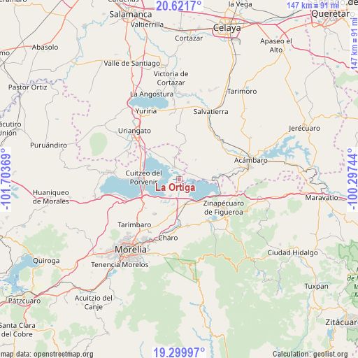
La Ortiga GPS coordinates[2]
19° 57' 43.992" North, 101° 0' 2.016" West
| Map corner | latitude | longitude |
|---|---|---|
| Upper-left | 20.6217°, | -101.70369° |
| Center: | 19.96222°, | -101.00056° |
| Lower-right: | 19.29997°, | -100.29744° |
| Map W x H: | 147×147 km | = 91.3×91.3mi |
| max Lat: | 32.7° ⇑43.8% North |
| La Ortiga: | 19.96222° |
| min Lat: | ⇓56.2% South 14.53588° |
| min Long | La Ortiga | max Long |
| -117.105° | -101.00056° | -86.73105° |
| W 26.5%⇐ | ⇒73.5% E |
Elevation
Elevation of La Ortiga is 1854 m = 6083 ft, and this is 600.3 m = 1969 ft above average elevation for this country.
| Max E: |
3497 m = 11473 ft | 33.9% |
| La Ortiga | 1854 m 6083 ft | |
| Avg. | 1253.7 m = 4113 ft | |
Min E: |
-1 m = -3 ft | 66.1% |
See also: Mexico elevation on elevation.city.
Geographical zone
La Ortiga is located in North Torrid zone (between Equator and Tropic of Cancer). Distance of this Northern Tropic circle is 386.3 km =240 mi to North.| Distance of | km | miles | from La Ortiga |
|---|---|---|---|
| North Pole | 7787.5 | 4838.9 | to North |
| Arctic Circle | 5181.6 | 3219.7 | to North |
| Tropic Cancer | 386.3 | 240 | to North |
| Equator | 2219.6 | 1379.2 | to South |


Nearby cities:
15 places around La Ortiga: (largest is in red/bold)
• Belisario Domínguez
10.5 km =6.5 mi,  163°
163°
• Chehuayo Grande
10.1 km =6.3 mi,  223°
223°
• Estación Queréndaro
10.4 km =6.5 mi,  148°
148°
• Felipe Carrillo Puerto
8.1 km =5 mi,  209°
209°
• Huacao
9.3 km =5.8 mi,  345°
345°
• Irámuco
8.2 km =5.1 mi,  90°
90°
• La Mina
7.5 km =4.7 mi,  166°
166°
• La Presa
7.8 km =4.8 mi, 209°
• Las Trojes
10.5 km =6.5 mi, 213°
• Lázaro Cárdenas (La Purísima)
10.6 km =6.6 mi,  192°
192°
• Mariano Escobedo
6.4 km =4 mi,  272°
272°
• San Agustín del Pulque
7.6 km =4.7 mi, 270°
• San Pablo Pejo
10.3 km =6.4 mi,  39°
39°
• Santa Ana Maya
5.4 km =3.4 mi,  335°
335°
• Tzintzimeo
10.5 km =6.5 mi, 166°
Sources, notices
• [Note1] Compared only with cities in Mexico existing in our database
• [Src1] Map data: © OpenStreetMap contributors (CC-BY-SA)
• [Src2] Other city data from geonames.org with taken over terms of usage.
• [Src3] Geographical zone / Annual Mean Temperature by Robert A. Rohde @ Wikipedia
