San Agustín del Pulque geodata
San Agustín del Pulque (Michoacán) is a populated place; located in Mexico in America/Mexico_City (GMT-6) time zone. With population of 3,561 people, there are 2568 cities with bigger population in this country. Compared to other cities in Mexico, 56.2% of cities are located further ↓South; 74% of cities are located further →East and 65.8% of cities have lower elevation than San Agustín del Pulque. Note1
Current local time in San Agustín del Pulque:
06:48 AM, WednesdayDifference from your time zone: hours


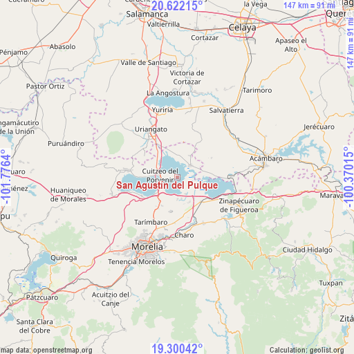
San Agustín del Pulque GPS coordinates[2]
19° 57' 45.612" North, 101° 4' 23.772" West
| Map corner | latitude | longitude |
|---|---|---|
| Upper-left | 20.62215°, | -101.7764° |
| Center: | 19.96267°, | -101.07327° |
| Lower-right: | 19.30042°, | -100.37015° |
| Map W x H: | 147×147 km | = 91.3×91.3mi |
| max Lat: | 32.7° ⇑43.8% North |
| San Agustín del Pulque: | 19.96267° |
| min Lat: | ⇓56.2% South 14.53588° |
| min Long | San Agustín de | max Long |
| -117.105° | -101.07327° | -86.73105° |
| W 26%⇐ | ⇒74% E |
Elevation
Elevation of San Agustín del Pulque is 1847 m = 6060 ft, and this is 593.3 m = 1947 ft above average elevation for this country.
| Max E: |
3497 m = 11473 ft | 34.2% |
| San Agustín del Pulque | 1847 m 6060 ft | |
| Avg. | 1253.7 m = 4113 ft | |
Min E: |
-1 m = -3 ft | 65.8% |
See also: Mexico elevation on elevation.city.
Geographical zone
San Agustín del Pulque is located in North Torrid zone (between Equator and Tropic of Cancer). Distance of this Northern Tropic circle is 386.3 km =240 mi to North.| Distance of | km | miles | from San Agustín del Pulque |
|---|---|---|---|
| North Pole | 7787.4 | 4838.9 | to North |
| Arctic Circle | 5181.5 | 3219.6 | to North |
| Tropic Cancer | 386.3 | 240 | to North |
| Equator | 2219.6 | 1379.2 | to South |


Nearby cities:
15 places around San Agustín del Pulque: (largest is in red/bold)
• Chehuayo Grande
7.3 km =4.5 mi,  175°
175°
• Chupícuaro
11.1 km =6.9 mi,  294°
294°
• Cuitzeo del Porvenir
7.3 km =4.5 mi,  276°
276°
• Doctor Miguel Silva (San Guillermo)
10.6 km =6.6 mi,  271°
271°
• Emiliano Zapata
9.5 km =5.9 mi, 180°
• Felipe Carrillo Puerto
8 km =5 mi,  152°
152°
• Huacao
10.4 km =6.5 mi,  30°
30°
• Jéruco
10.1 km =6.3 mi, 275°
• La Lobera
8.8 km =5.5 mi,  5°
5°
• La Ortiga
7.6 km =4.7 mi,  90°
90°
• La Presa
7.8 km =4.8 mi, 151°
• Las Trojes
8.9 km =5.5 mi,  168°
168°
• Mariano Escobedo
1.2 km =0.7 mi,  78°
78°
• San Juan Benito Juárez (San Juan Tararameo)
7.7 km =4.8 mi,  228°
228°
• Santa Ana Maya
7.3 km =4.5 mi,  47°
47°
Sources, notices
• [Note1] Compared only with cities in Mexico existing in our database
• [Src1] Map data: © OpenStreetMap contributors (CC-BY-SA)
• [Src2] Other city data from geonames.org with taken over terms of usage.
• [Src3] Geographical zone / Annual Mean Temperature by Robert A. Rohde @ Wikipedia
